Les Brévières and Tignes 1800
Access: Community lower gondola references
Confirm your actual village, open link and last return; a gondola alignment does not guarantee a ski descent or download.
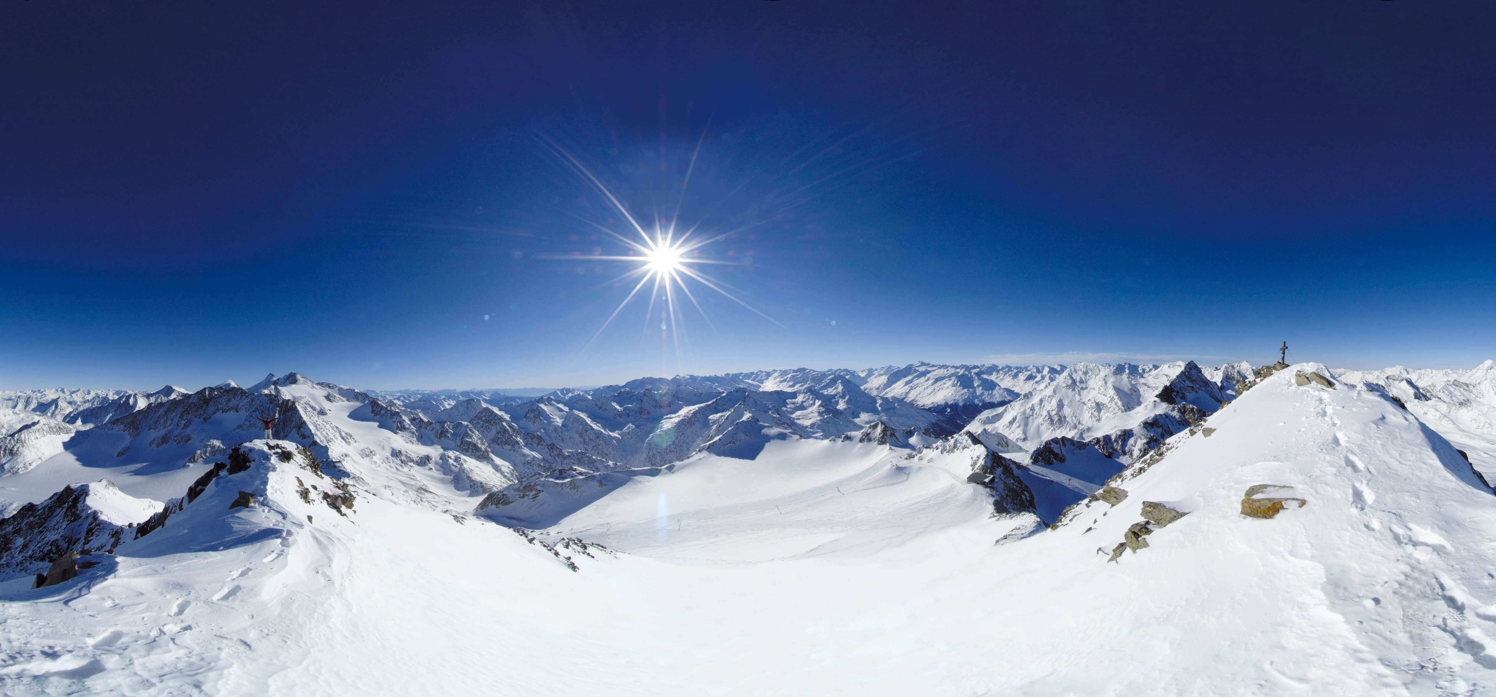 Live nowStubai Zoo Park & Test DaysThe organiser lists Stubai Zoo Park & Test Days for 6–8 November 2026 at Stubai Glacier and in Neustift, Austria. Equipment testing at Eisgrat is scheduled only for Saturday 7 and Sunday 8 November.
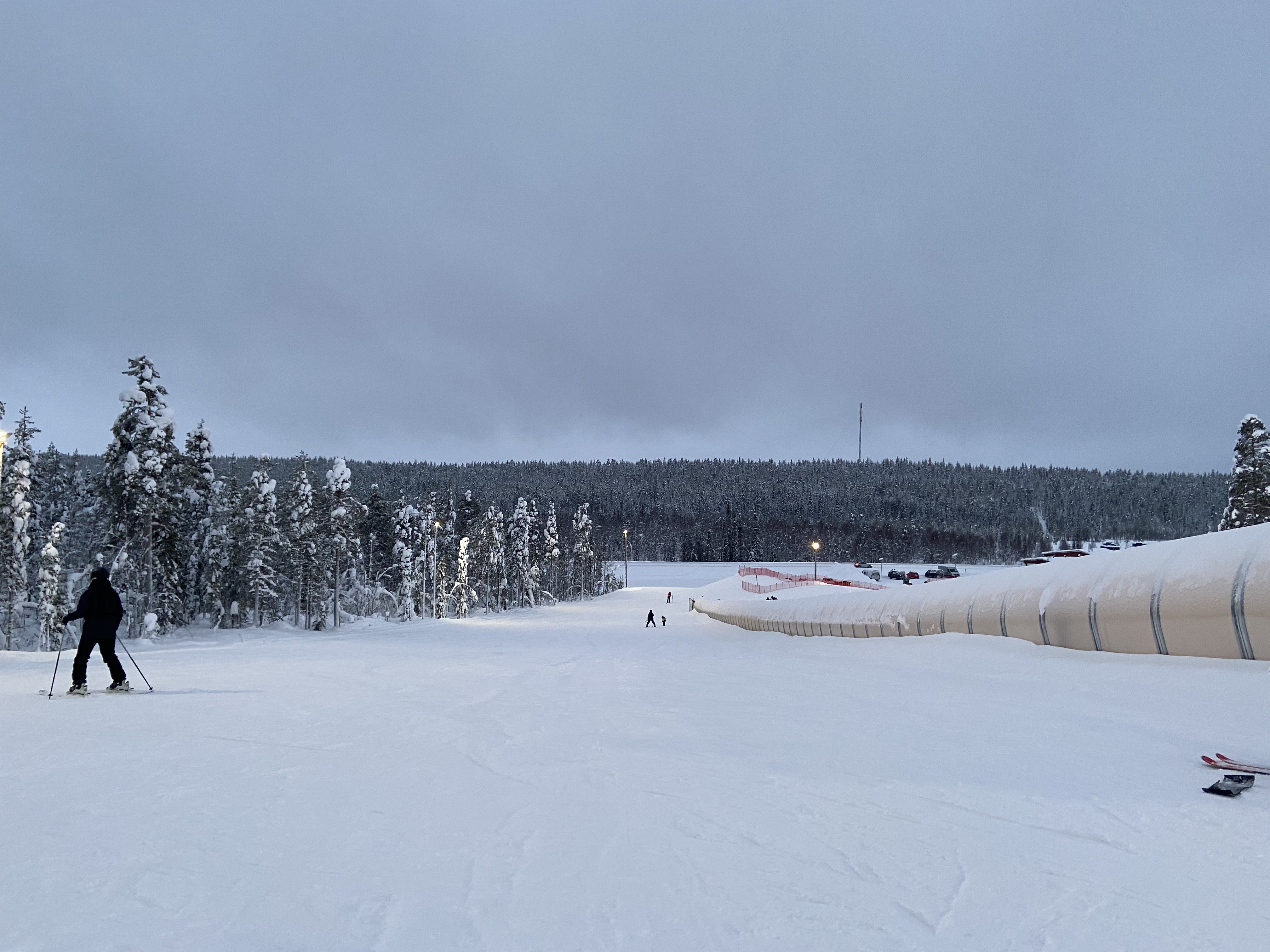 UpcomingLevi World CupThe FIS calendar schedules the women’s and men’s slalom races for 14–15 November in Lapland.
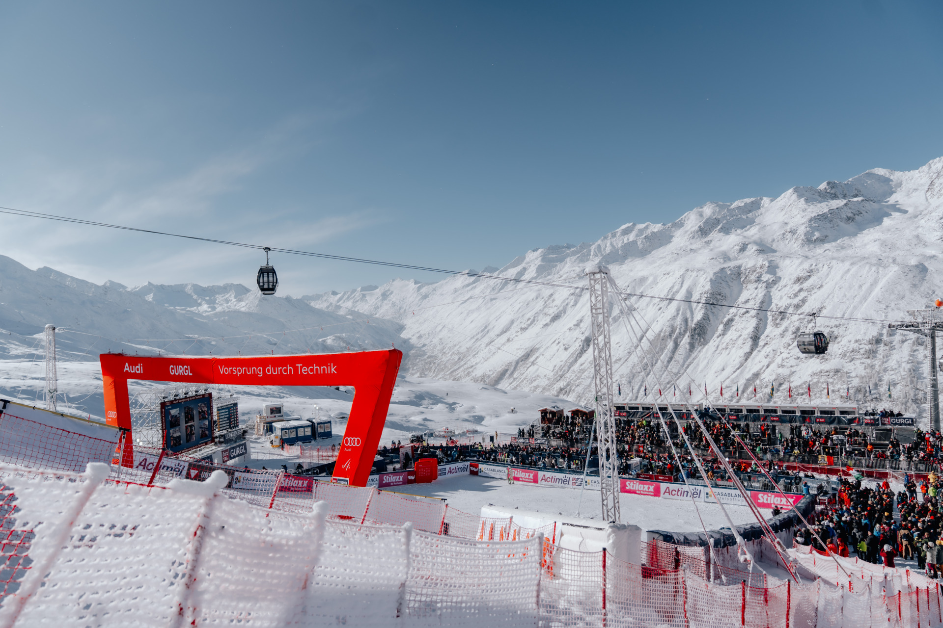 UpcomingGurgl World CupWomen’s and men’s slalom races are scheduled on the Kirchenkar World Cup piste on 21–22 November.
PLACE FR-002 / Vanoise Alps
Plan Tignes’ managed alpine terrain with an independent map, village-base and return orientation, source-linked ticket and transport advice, and explicit limits on current skiing and glacier access.
 068
MAPS / UNDERSTAND THE AREA
Explore the independent community map and practical starting bases. Read the coverage limits and check current opening and access with the operator.
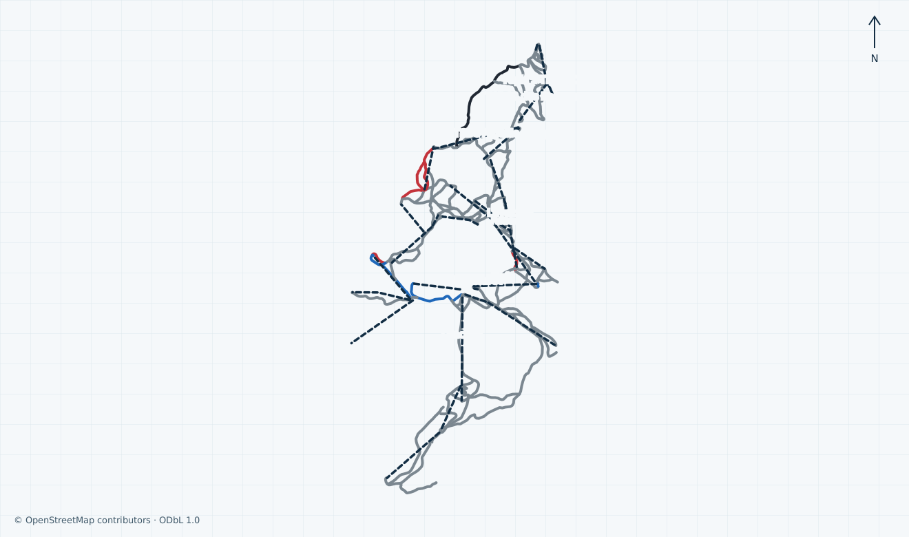
Colours show the published skiing status or confirmed operating calendar, not whether every lift is running. Check the operator before travel.
Confirmed dates change colours automatically in the place’s local time. Tentative dates, conflicting reports and expired checks remain black.
Unconfirmed: the operator winter-map landing page is linked, but its printed edition and artwork preview or reproduction rights have not been verified. Unconfirmed: a current official-plan edition with a verified remote-display basis has not been established; operator artwork, previews and restricted tourism links are omitted. The independent extent covers available Tignes-side downhill corridors and passenger alignments from Les Brévières and 1800 through Le Lac/Lavachet, Val Claret, western sectors and Grande Motte. Eastern Val d’Isère/border ways, area polygons, removed and uncertain installations, club/training/snowtubing, unnamed/unlisted and backcountry/extreme terrain are omitted. The Perce-Neige railway funicular is not drawn. Termignon’s season tags conflict and its lifts are omitted. Grey pistes have no verified local colour. Segments are not a full inventory, current footprint, ticket entitlement, open connection, safe-return guarantee or navigation.
HOW THE AREA CONNECTS
Access: Community lower gondola references
Confirm your actual village, open link and last return; a gondola alignment does not guarantee a ski descent or download.
Access: Community village-base passenger alignments
Separate your accommodation, school meeting point and boarding base; not all classes meet in every village.
Access: Scoped community alpine references
Glacier access and current sector connections need staff confirmation; removed, uncertain, neighbouring and unpatrolled objects are omitted.
The pin is near the community Le Lac / Palafour base. Les Brévières, Tignes 1800 and Val Claret are distinct arrival and school choices. Confirm your accommodation transfer, lesson meeting point, required pass and boarding assistance before setting off.
Community alignments distinguish lower gondolas, Le Lac/Tovière, Val Claret/Tichot/Lanches and western or Grande Motte corridors. Confirm suitable signed open links locally. A partner-domain pass and an open connection to Val d’Isère are separate checks; the railway funicular is not drawn.
Ask staff for a descent suitable for your ability to the correct village, or expressly permitted download, then verify the last ground transfer. Weather and technical interruption may close lifts. A community line, product period or historical shuttle file cannot guarantee your return.
01 / FIELD OVERVIEW
Tignes alpine planning guide with independent map, village and return orientation, ticket scope, Bourg-Saint-Maurice transport, skiing safety and dated source limitations.
Independent Tignes-side alpine map
Village-base and complete-return orientation
Distinct Tignes-only and combined-domain ticket scope
This guide covers Tignes’ managed alpine terrain around Les Brévières, Tignes 1800, Le Lac, Le Lavachet and Val Claret, with the Grande Motte side shown where lawful community geometry is available. Val d’Isère, Sainte-Foy, Nordic trails, touring tracks, freestyle facilities and unpatrolled ground are separate scopes.
ALTTA describes a 300 km domain linked with Val d’Isère. That combined figure is not a verified Tignes-only length or piste count. The independent map retains community names and raw difficulty tags; grey lines have no independently verified local colour. Follow actual local signs and staff advice.
Unconfirmed: a complete current Tignes-only piste and passenger-installation inventory, exact signed grades for each mapped segment and the operating footprint of the glacier have not been established. Community segments are not counted as pistes, and old alignments do not establish a usable connection.
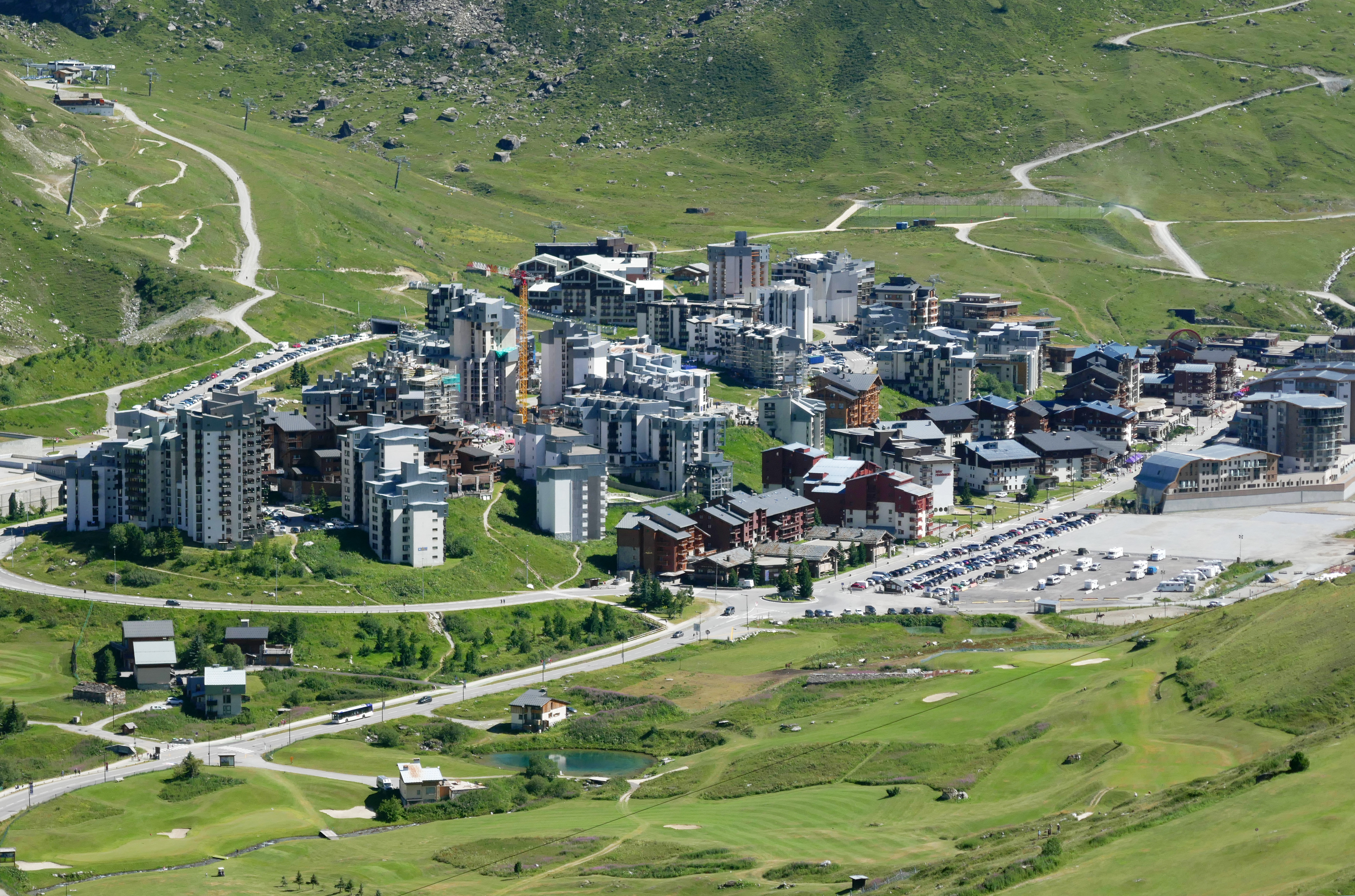
Historical: Tiia Monto’s genuine photograph shows Val Claret village and green alpine surroundings on 27 July 2023. The original JPEG is unchanged, with responsive display crops under CC BY-SA 4.0. This summer archive context does not establish present snow, lift condition or skiing.
The independent map distinguishes the lower Brévières and Boisses gondola alignments, Le Lac-side Palafour, Chaudannes and Tovière references, Val Claret-side Tichot and Lanches, and upper Grande Motte corridors. These are community labels and alignments, not an operator-certified installation list or permission to board.
ALTTA’s use conditions distinguish its own installations from partner lifts, including STVI, available only where the purchased offer expressly includes them. The same conditions warn that weather, snow, technical constraints or other operating decisions may interrupt installations. A Tignes-only ticket must not be treated as a combined-domain pass.
Unconfirmed: daily first and last lift times, exact open inter-sector links, equipment-specific boarding, accessible assistance, authorised download and a suitable return to your village are not established. The railway funicular Perce-Neige is not drawn on this independent map. Termignon’s conflicting community season tags and removed glacier lifts are omitted. Ask staff for your complete return before ascending.
Altibus identifies the year-round S83 link from Bourg-Saint-Maurice to Tignes, with seasonal frequency changes. It specifically renames the Val Claret Rond Point stop as Val Claret – Ecrin des neiges. Confirm the stop nearest your actual accommodation and ski base; a village stop is not a doorstep or accessible lift transfer.
The municipality regulates parking throughout Tignes and directs winter 2026/27 subscriptions to its parking provider. Use signed parking and unloading areas and arrange the final ground transfer; the location pin is only a planning reference near the community-mapped Le Lac base, not a reserved space or surveyed entrance.
Historical: the municipal mobility page retains a summer Tignes–Val d’Isère shuttle with conflicting 2025/2026 wording, and a guide described as winter 2025/26 while linking to a summer/autumn 2026 file. None is an accepted winter 2026/27 timetable.
Unconfirmed: exact winter shuttle departures, last return, fares for your journey, accessible boarding and a guaranteed connection after the final lift have not been established. Book both outward and return travel for the actual date and village, allow for winter road disruption and check current road restrictions with the carrier and authorities.
At the 4 November 2026 check, ALTTA’s homepage announces the ski-area season from 21 November 2026 to 2 May 2027. Its ski-pass grid lists a Tignes-only opening product at €50 for one day within 21–27 November, with later product periods through 2 May. These are published plans and products, not confirmed current skiing, guaranteed snow or a complete daily lift and return timetable.
For the combined Tignes–Val d’Isère domain, Val d’Isère’s 2026/27 grid lists €78 for ages 19–64 and €63 for ages 8–18 or 65–74 for one day from 12 December 2026 to 23 April 2027. This does not price a Tignes-only day. Check the actual seller, date, category proof, card and collection requirements before payment; no bookable offer is asserted here.
ALTTA’s sale and use conditions, effective 19 June 2026, distinguish tickets, activities and optional insurance. Pedestrian titles do not permit carrying ski equipment. Online cancellation and interruption compensation have specific deadlines, eligible products and closure thresholds; weather disruption does not create an automatic universal refund. Read the applicable current conditions and keep the purchase proof.
Unconfirmed: successful checkout availability for your date, final applicable extras, exact lesson or equipment inclusions and a future guaranteed opening or final ski day are not established. The published ticket periods must not turn a place point green. ESF’s required pass varies by level and progression; ask your instructor before purchasing.
ALTTA requires compliance with the rules displayed at each installation, signs and staff instructions, and recommends the recognised ten rules for piste users. Stay on signed open pistes appropriate to your ability; do not interpret a line, summer photograph or paid ticket as uphill, off-piste or closed-terrain permission.
The municipality identifies ALTTA’s piste service as responsible for marking, snow preparation, avalanche control and mountain rescue, and lists +33 4 79 06 32 00 for the piste alert centre. Give staff the exact piste and nearest marker when reporting an incident. Rescue can be charged; verify insurance scope and exclusions before skiing.
Unconfirmed: present patrol deployment, an accepted current rescue tariff, safe glacier access and a complete open descent or permitted passenger download for your chosen base have not been verified. Do not cross closed sectors or glaciers to complete a mapped circuit. Arrange staff-approved alternatives if visibility, weather, closures or your ability prevent the return.
ESF distinguishes Le Lac, Tignes 1800, Les Brévières and Val Claret teaching bases and warns that some advanced groups meet only at Le Lac. Confirm the village and exact meeting point on the lesson booking rather than assuming every school desk or ski link serves the same class.
The school offers instruction for several ages and disciplines and advertises adaptive skiing. Its recommendations say equipment is not included in its lessons; children must arrive with skis, boots and a helmet. Reserve suitable rental equipment and fitting separately, and ask which lift pass is needed as the class progresses.
ALTTA’s current legal notice lists info@altta.fr and +33 4 79 06 60 00 for its Val Claret establishment. These are public operator contacts, not tested response lines. The municipal piste-service office lists winter public hours of 08:30–17:30; these are office hours, not a lift or skiing timetable.
Unconfirmed: current rental stock and prices, instructor availability and languages, adaptive equipment, step-free routes, lift-specific assistance and the opening of individual desks or restaurants for your date have not been established. Agree the fitting, lesson, collection and equipment-return times directly before travelling.
Selected historical name and local-grade references only. The coverage note explains the unavailable current official plan. This list establishes neither the full inventory nor current opening or access.
04 / AT THE BASE
05 / PROFILE BASIS & SOURCES
This profile is based on current information published or supplied by the place or its operator and the dated sources linked below.
All ten scopes reviewed through current operator, municipal, carrier and ski-school sources. Product periods, historical transport, uncertain inventory/access and omitted restricted tourism links remain explicit; no artwork comparison or personal operator confirmation.
The hero image is an authentic photograph by Tiia Monto, reused under the CC BY-SA 4.0 license.
Historical: Tiia Monto’s genuine photograph shows Val Claret village and green alpine surroundings on 27 July 2023. The original JPEG is unchanged, with responsive display crops under CC BY-SA 4.0. This summer archive context does not establish present snow, lift condition or skiing.
Independent source-scoped factual planning, with the precise historical and unconfirmed limits stated in the guide; no artwork reuse or current access inferred.
Independent source-scoped factual planning, with the precise historical and unconfirmed limits stated in the guide; no artwork reuse or current access inferred.
Independent source-scoped factual planning, with the precise historical and unconfirmed limits stated in the guide; no artwork reuse or current access inferred.
Independent source-scoped factual planning, with the precise historical and unconfirmed limits stated in the guide; no artwork reuse or current access inferred.
Independent source-scoped factual planning, with the precise historical and unconfirmed limits stated in the guide; no artwork reuse or current access inferred.
Independent source-scoped factual planning, with the precise historical and unconfirmed limits stated in the guide; no artwork reuse or current access inferred.
Independent source-scoped factual planning, with the precise historical and unconfirmed limits stated in the guide; no artwork reuse or current access inferred.
Independent source-scoped factual planning, with the precise historical and unconfirmed limits stated in the guide; no artwork reuse or current access inferred.
Independent source-scoped factual planning, with the precise historical and unconfirmed limits stated in the guide; no artwork reuse or current access inferred.
Independent source-scoped factual planning, with the precise historical and unconfirmed limits stated in the guide; no artwork reuse or current access inferred.
Independent source-scoped factual planning, with the precise historical and unconfirmed limits stated in the guide; no artwork reuse or current access inferred.
Independent source-scoped factual planning, with the precise historical and unconfirmed limits stated in the guide; no artwork reuse or current access inferred.
Independent source-scoped factual planning, with the precise historical and unconfirmed limits stated in the guide; no artwork reuse or current access inferred.
Independent source-scoped factual planning, with the precise historical and unconfirmed limits stated in the guide; no artwork reuse or current access inferred.
Independent source-scoped factual planning, with the precise historical and unconfirmed limits stated in the guide; no artwork reuse or current access inferred.
Independent source-scoped factual planning, with the precise historical and unconfirmed limits stated in the guide; no artwork reuse or current access inferred.
Independent source-scoped factual planning, with the precise historical and unconfirmed limits stated in the guide; no artwork reuse or current access inferred.
Independent source-scoped factual planning, with the precise historical and unconfirmed limits stated in the guide; no artwork reuse or current access inferred.
Rendered on 3 November 2026: downloadable piste-plan and interactive-domain controls. Ordinary page link only; no artwork, verified printed edition, preview or reproduction grant.