Erzurum-side lower bases
Access: Community gondola and lower passenger-lift references
Confirm the correct boarding and lesson base; nearby hotel lifts do not establish shared pass entitlement.
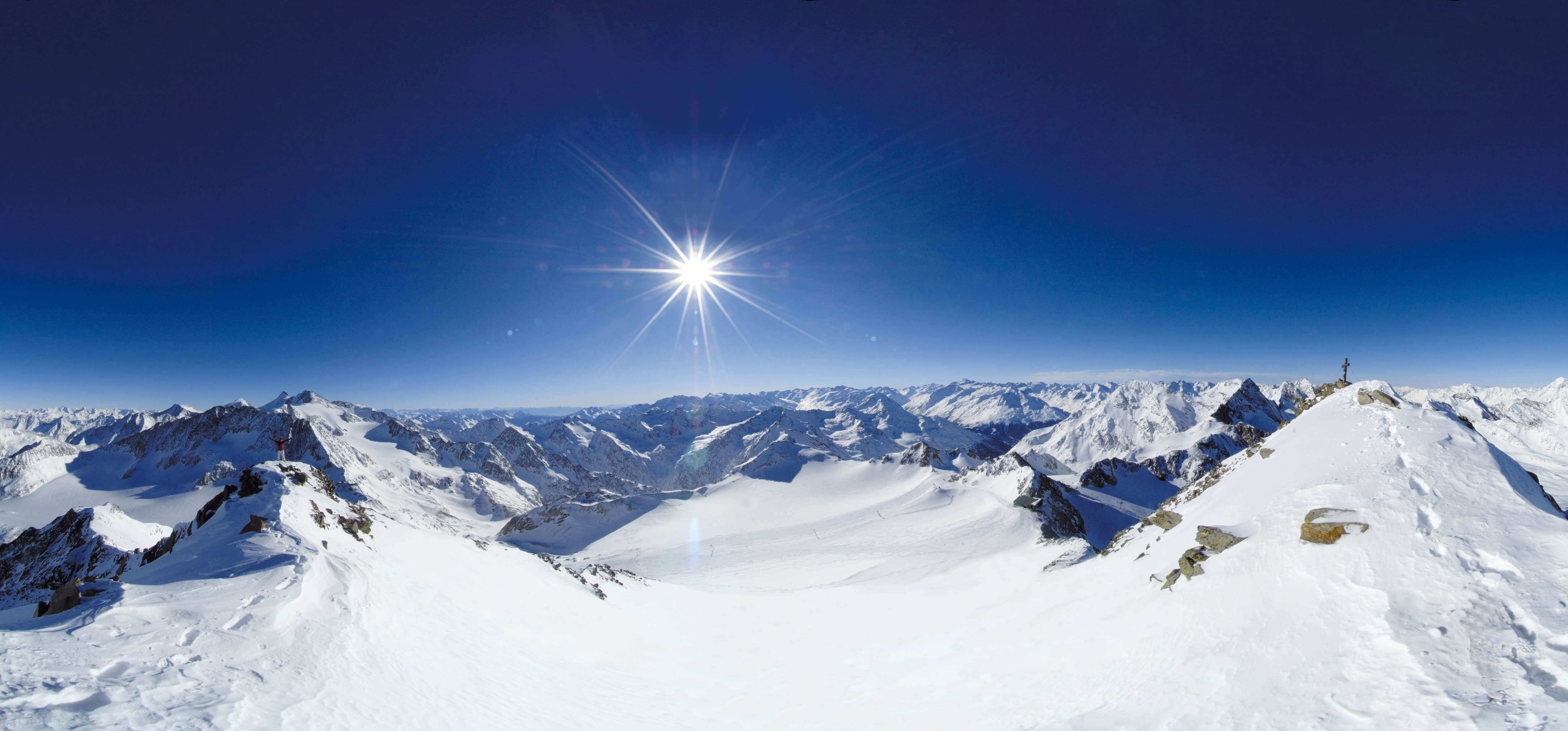 Live nowStubai Zoo Park & Test DaysThe organiser lists Stubai Zoo Park & Test Days for 6–8 November 2026 at Stubai Glacier and in Neustift, Austria. Equipment testing at Eisgrat is scheduled only for Saturday 7 and Sunday 8 November.
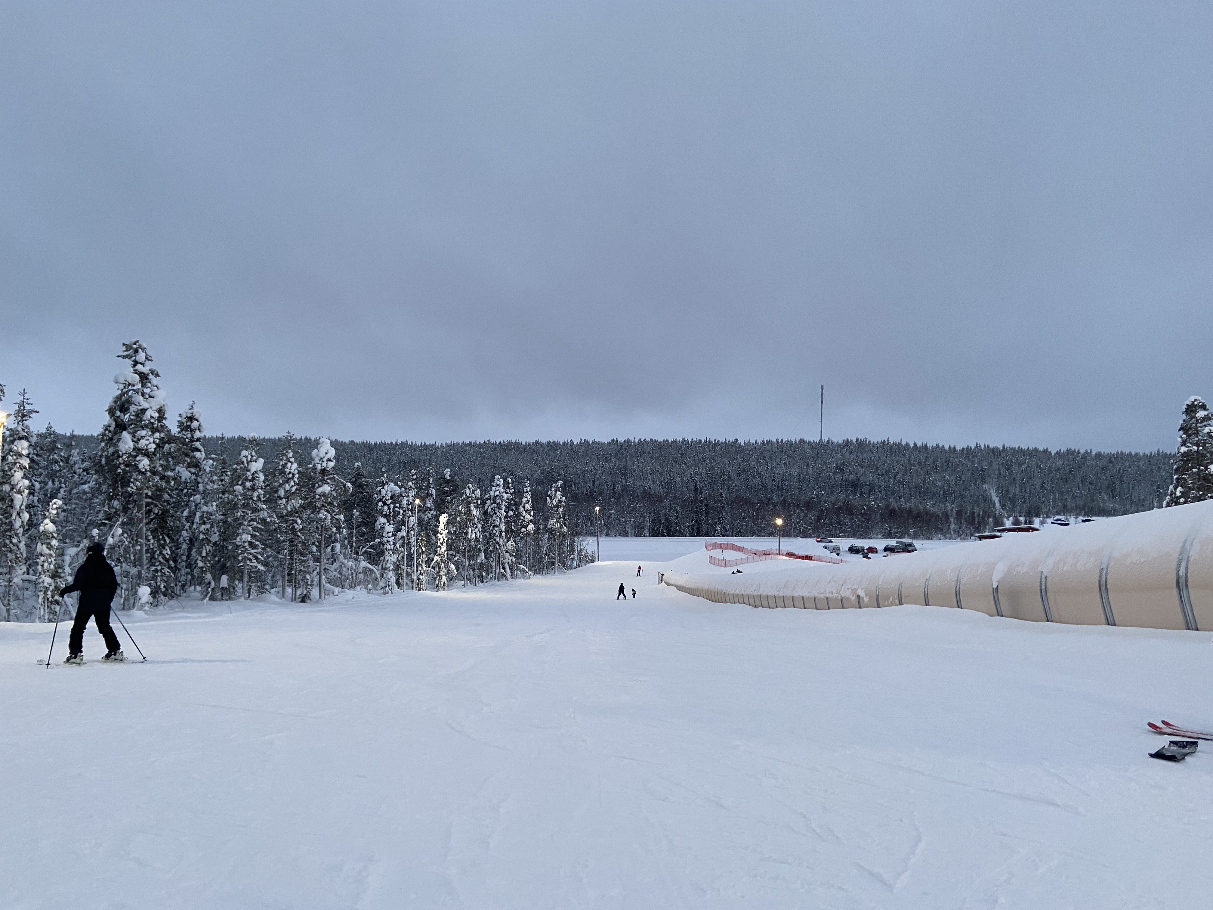 UpcomingLevi World CupThe FIS calendar schedules the women’s and men’s slalom races for 14–15 November in Lapland.
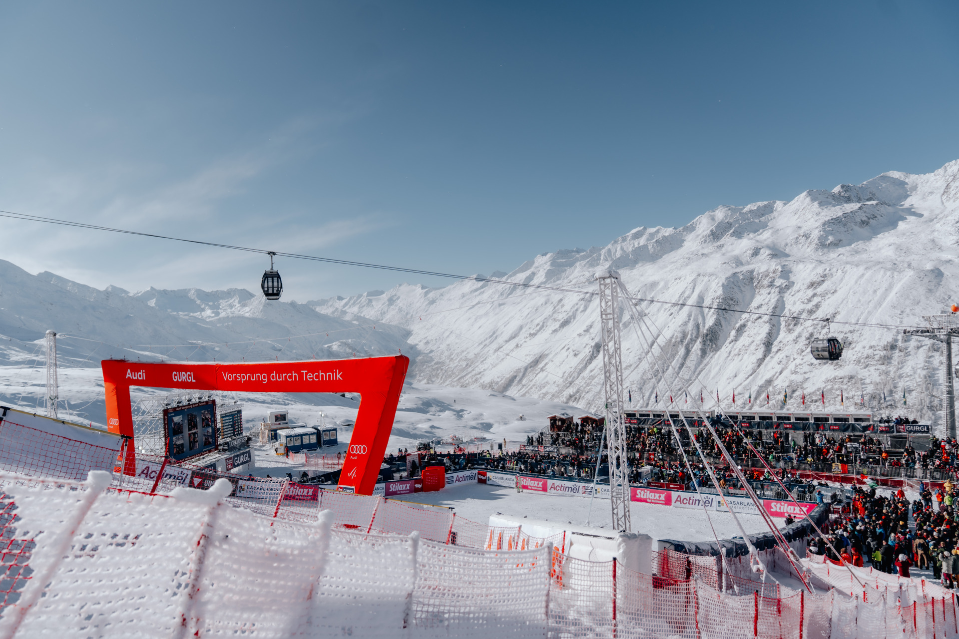 UpcomingGurgl World CupWomen’s and men’s slalom races are scheduled on the Kirchenkar World Cup piste on 21–22 November.
PLACE TR-002 / Palandöken Mountains
Plan Palandöken’s managed alpine slopes above Erzurum with an independent map, gondola-base and return orientation, source-linked practical advice and explicit limits on current winter operations.
 067
MAPS / UNDERSTAND THE AREA
Explore the independent community map and practical starting bases. Read the coverage limits and check current opening and access with the operator.
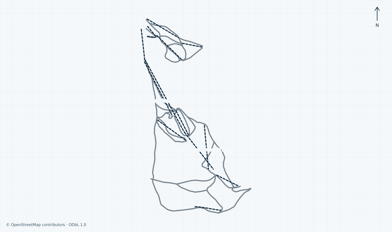
Colours show the published skiing status or confirmed operating calendar, not whether every lift is running. Check the operator before travel.
Confirmed dates change colours automatically in the place’s local time. Tentative dates, conflicting reports and expired checks remain black.
Unconfirmed: a current official-plan edition and lawful remote-display basis could not be verified; operator artwork, previews and comparison claims are omitted. The independent extent covers community downhill corridors and passenger alignments on Palandöken above Erzurum, including separately labelled hotel-side references. Konaklı and Kandilli are outside this scope. Uncertain 5 a, 5b and Speed Slope training identities are omitted, along with technical, private, proposed, disused and backcountry/freeride/extreme features. Grey pistes have no verified local colour. Segments are not a resort inventory, current footprint, open connection, ticket entitlement, safe-return guarantee or navigation.
HOW THE AREA CONNECTS
Access: Community gondola and lower passenger-lift references
Confirm the correct boarding and lesson base; nearby hotel lifts do not establish shared pass entitlement.
Access: Community Vadi, Gelincik, Kardelen and neighbouring downhill references
Names retain OSM spelling. Check the actual signed grade, open connection and return; no operator-artwork match is claimed.
Access: Community upper gondola and Kapı kaya references
Fog, wind, visibility and avalanche decisions affect availability; a mapped alignment does not permit closed or unpatrolled terrain.
The pin uses the community lower Gondola 1 endpoint. Mountain and city accommodation are separate arrival choices; hotel-side Polat 2 and other lower lifts are map references, not proof of shared pass coverage. Confirm your precise boarding, lesson or rental meeting point and required assistance.
Community geometry distinguishes lower corridors, the two labelled gondola alignments and the upper Kapı kaya reference. Ask staff for suitable signed open links and local grades. Konaklı and Kandilli are separate; no inter-resort ski connection or operator-plan equivalence is inferred.
Agree a suitable open descent to your actual base, or an expressly permitted passenger download, and check the final lift and ground transfer separately. Fog and avalanche risk can close Ejder terrain; old seasonal descriptions and a mapped line cannot guarantee your return.
01 / FIELD OVERVIEW
Palandöken alpine guide with independent map, Erzurum arrival, gondola-base orientation, skiing safety, ticket checks and visible seasonal and source limitations.
Independent Palandöken alpine map
Erzurum-side base and complete-return orientation
Separate Konaklı scope and explicit winter limitations
Palandöken is the managed alpine ski area on the mountain south of Erzurum. The provincial tourism directorate describes Palandöken and Konaklı separately and identifies Kandilli as a Nordic venue. This guide covers the Palandöken downhill area, not a combined linked circuit, Kandilli trails, ski-jumping facilities or unpatrolled touring terrain.
Conflicting sources: the provincial tourism page attributes 44 pistes and 51 km to Palandöken and 55 pistes to Palandöken plus Konaklı. The municipality’s Palandöken page instead advertises 55 pistes, 87 km and 19 lifts without the same separation. The retained municipal-sports page describes 22 pistes and 28 km. These claims are not one verified current inventory.
The older ministry and district descriptions identify Ejder and Kapıkaya as competition references. Community data also carries names such as Vadi, Gelincik and Kardelen; its spelling and generic difficulty tags are preserved without claiming exact equivalence to an uninspected operator plan. Follow local signs; grey geometry has no independently verified local colour.
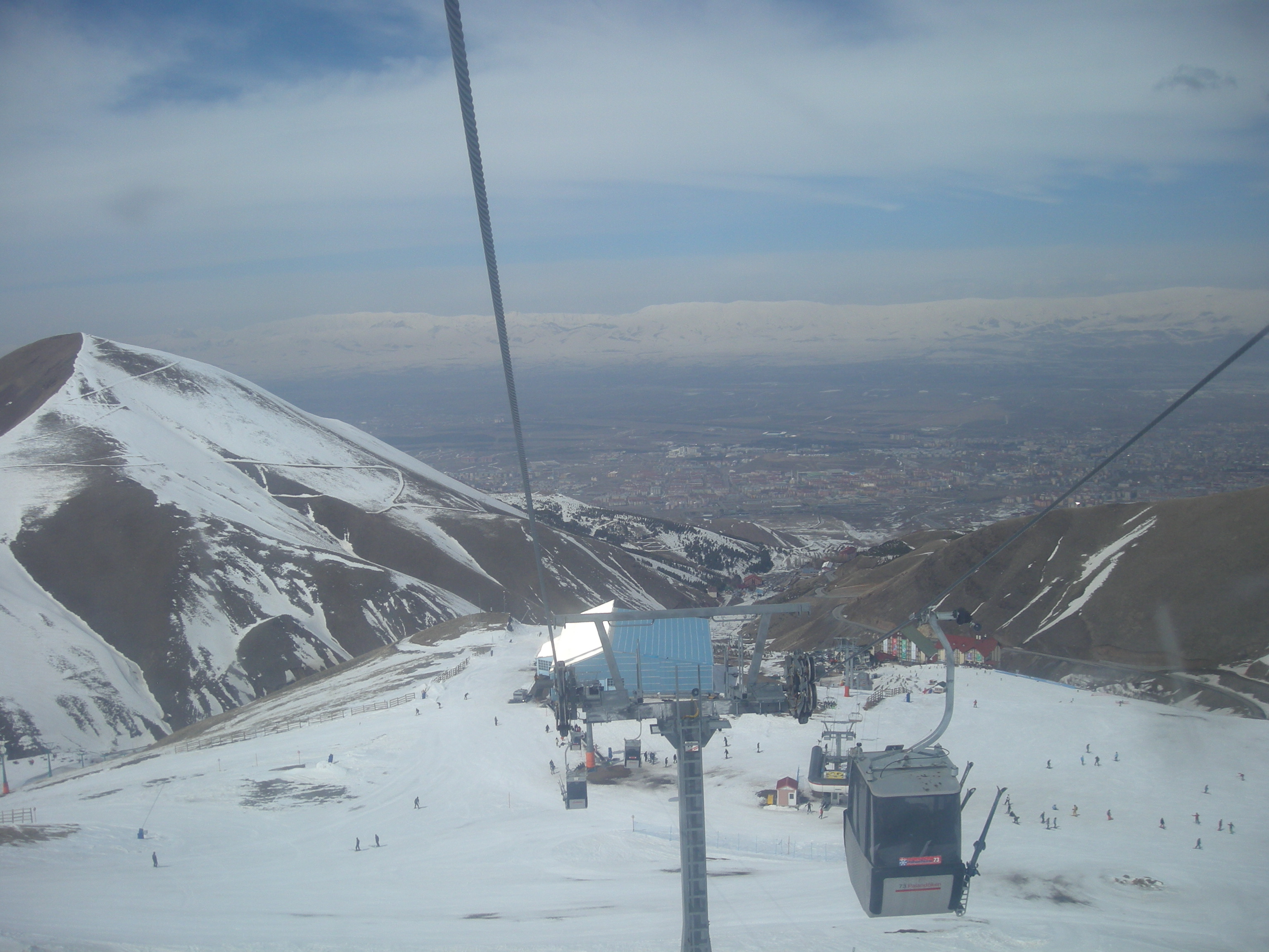
Historical: hüseyin yeşil’s genuine photograph shows Palandöken slopes, cable infrastructure and Erzurum on 20 March 2011. The original JPEG is unchanged, with responsive display crops under CC BY 3.0. This archive context does not establish current snow, lift condition, operating footprint or skiing.
The independent map distinguishes the community-labelled Palandöken Gondola 1 and Palandöken Gondola 2 alignments, central passenger lifts and lower hotel-side references, including Polat 2. Their labels and geography are community evidence, not confirmation of engineering condition, current service, ownership boundaries or a shared pass.
Historical: the ministry describes five chairlifts, one T-bar, two learner lifts and a gondola; municipal-sports and other tourism descriptions use different totals. The district’s 20 June 2019 page describes ascent towards Ejder. Those retained descriptions are not a verified 2026/27 installation inventory or a current boarding instruction.
Unconfirmed: exact present sector links, accessible boarding, permitted passenger download, final departures and a complete suitable descent to each lower base have not been established. Before ascending, ask staff which signed route matches your ability and returns to your actual meeting point. Do not assume a skiable connection to Konaklı or that a hotel-side lift accepts your ticket.
The ministry places the ski area south of Erzurum and describes winter buses between the mountain and city. Accommodation is described both at the mountain and in Erzurum. Choose the actual ski-school, rental or passenger-lift base before booking a city-to-mountain transfer; the location pin is only a community geometry reference.
Conflicting sources: the retained district description gives 4 km from the city and 15 km from the airport, while municipal sports gives 7 km from the city and about 30 minutes from the airport. The ministry gives 5 km from the city and ten minutes from the airport. Different origins and old travel claims cannot provide one reliable present journey time.
Unconfirmed: a dated 2026/27 bus or shuttle timetable, last return, current winter road restrictions, parking charges and availability, and step-free transfer to a specific lift are not established. Confirm the actual operator, departure point, accessible assistance and return reservation for your date; allow for winter road and weather disruption.
The municipality’s official Palandöken app listing identifies Ejder Kayak Merkezleri A.Ş. and describes ski-pass and rental-price information for both Palandöken and Konaklı. An app’s advertised functions and a common operator name do not establish that a particular ticket covers both areas or every hotel-side installation.
Unconfirmed: current 2026/27 ski-pass prices, adult and child age boundaries, card or deposit charges, day versus night validity, equipment or lesson inclusions, and refund or weather-closure terms have not been verified. The publicly indexed operator sales-contract destination returned 403 during direct verification; no contract acceptance or current offer is inferred.
Before payment, ask the actual seller to identify the ski area and permitted lifts, date and duration, category proof, card charges and collection point. Check whether night skiing, instruction or rental requires a separate booking, and read the applicable cancellation terms. No price or bookable Offer is presented here without verified current scope.
GoTürkiye explicitly warns that fog and avalanche risk can close Ejder lifts and pistes. Treat high mountain visibility and avalanche decisions as access constraints, even when lower lifts or sightseeing services operate. Follow closures, local signs and staff; ski within your ability and wear appropriate protective equipment.
Historical: the Interior Ministry’s 31 January 2021 account describes JAK mountain-rescue teams at Palandöken and Konaklı and transfer of casualties to the 112 emergency service. Its staffing and response-time descriptions are historical, not a guarantee of current patrol deployment, rescue time, cost or medical cover.
Unconfirmed: current patrol contacts and medical arrangements, uphill permissions, training-area access and an open return for your particular base have not been established. Ask staff before setting out. This guide grants no closed-piste, off-piste or uphill permission; keep clear of grooming and snowmaking work and arrange an authorised return if conditions or your ability prevent descent.
The ministry describes ski instruction, equipment rental and hotel restaurants, with accommodation on the mountain and in Erzurum. These are useful service categories to arrange directly, rather than a guarantee that a particular desk, class or restaurant is open for your visit.
The municipal-sports facility page lists +90 442 317 08 04 for Palandöken; the municipality’s main contact is +90 442 344 10 00. The official municipality-published app lists info@ejder3200.com for support. These are public directory contacts, not independently tested response lines or an emergency-service guarantee.
Unconfirmed: current lesson and rental tariffs, instructor languages, age and group rules, equipment availability, adaptive instruction, accessible facilities and staffed medical provision have not been established. Agree the precise meeting point, fitting and collection times, required pass and equipment-return deadline with your chosen provider before travelling.
Selected historical name and local-grade references only. The coverage note explains the unavailable current official plan. This list establishes neither the full inventory nor current opening or access.
04 / AT THE BASE
05 / PROFILE BASIS & SOURCES
This profile is based on current information published or supplied by the place or its operator and the dated sources linked below.
All ten review scopes checked using accessible municipal, government and national tourism sources, alongside actual failed operator text/contract access. Precise historical, conflicting and unknown scope remains visible; no operator reply, artwork comparison or current skiing is claimed.
The hero image is an authentic photograph by hüseyin yeşil, reused under the CC BY 3.0 license.
Historical: hüseyin yeşil’s genuine photograph shows Palandöken slopes, cable infrastructure and Erzurum on 20 March 2011. The original JPEG is unchanged, with responsive display crops under CC BY 3.0. This archive context does not establish current snow, lift condition, operating footprint or skiing.
Source access limitation only; no current skiing, timetable, artwork or ticket terms accepted.
Attributed independent factual scope with explicit historical, conflicting or unconfirmed limits; no operator endorsement or artwork reuse inferred.
Attributed independent factual scope with explicit historical, conflicting or unconfirmed limits; no operator endorsement or artwork reuse inferred.
Attributed independent factual scope with explicit historical, conflicting or unconfirmed limits; no operator endorsement or artwork reuse inferred.
Attributed independent factual scope with explicit historical, conflicting or unconfirmed limits; no operator endorsement or artwork reuse inferred.
Attributed independent factual scope with explicit historical, conflicting or unconfirmed limits; no operator endorsement or artwork reuse inferred.
Attributed independent factual scope with explicit historical, conflicting or unconfirmed limits; no operator endorsement or artwork reuse inferred.
Attributed independent factual scope with explicit historical, conflicting or unconfirmed limits; no operator endorsement or artwork reuse inferred.
Attributed independent factual scope with explicit historical, conflicting or unconfirmed limits; no operator endorsement or artwork reuse inferred.
Actual failed direct verification only; no current contractual terms accepted.
Independent licensed geometry and original labels, without local colour conversion or present access inference.
Genuine 20 March 2011 archive context and CC BY 3.0, not current conditions.