Prapoutel
Access: Western road base at an advertised 1,350 m, with shops and several separate beginner and mountain lift starts.
Choose the exact lesson or ticket meeting point; a village arrival does not put you at every lift.
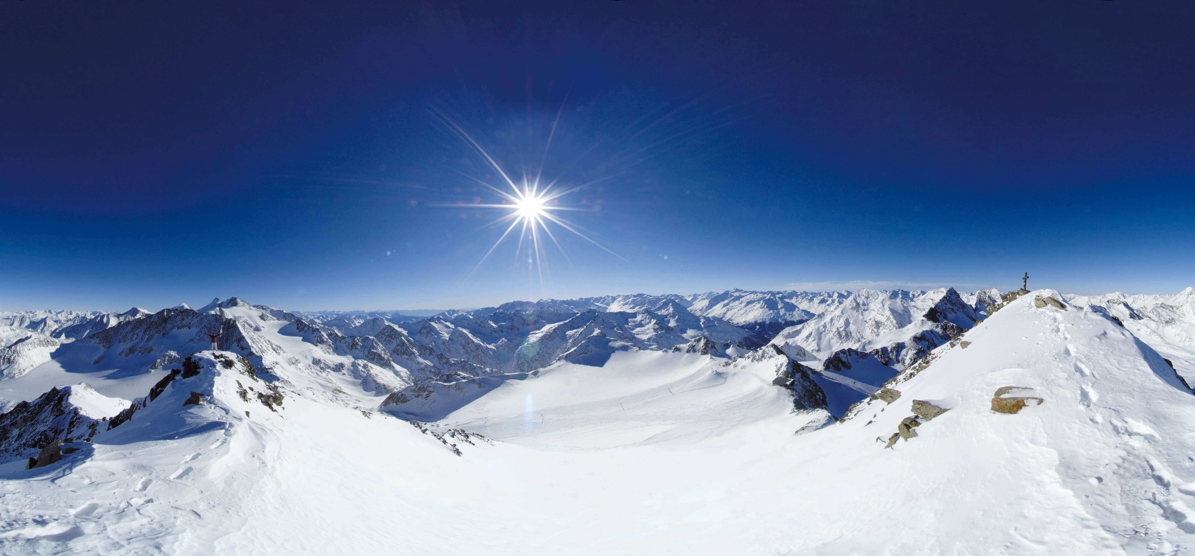 Live nowStubai Zoo Park & Test DaysThe organiser lists Stubai Zoo Park & Test Days for 6–8 November 2026 at Stubai Glacier and in Neustift, Austria. Equipment testing at Eisgrat is scheduled only for Saturday 7 and Sunday 8 November.
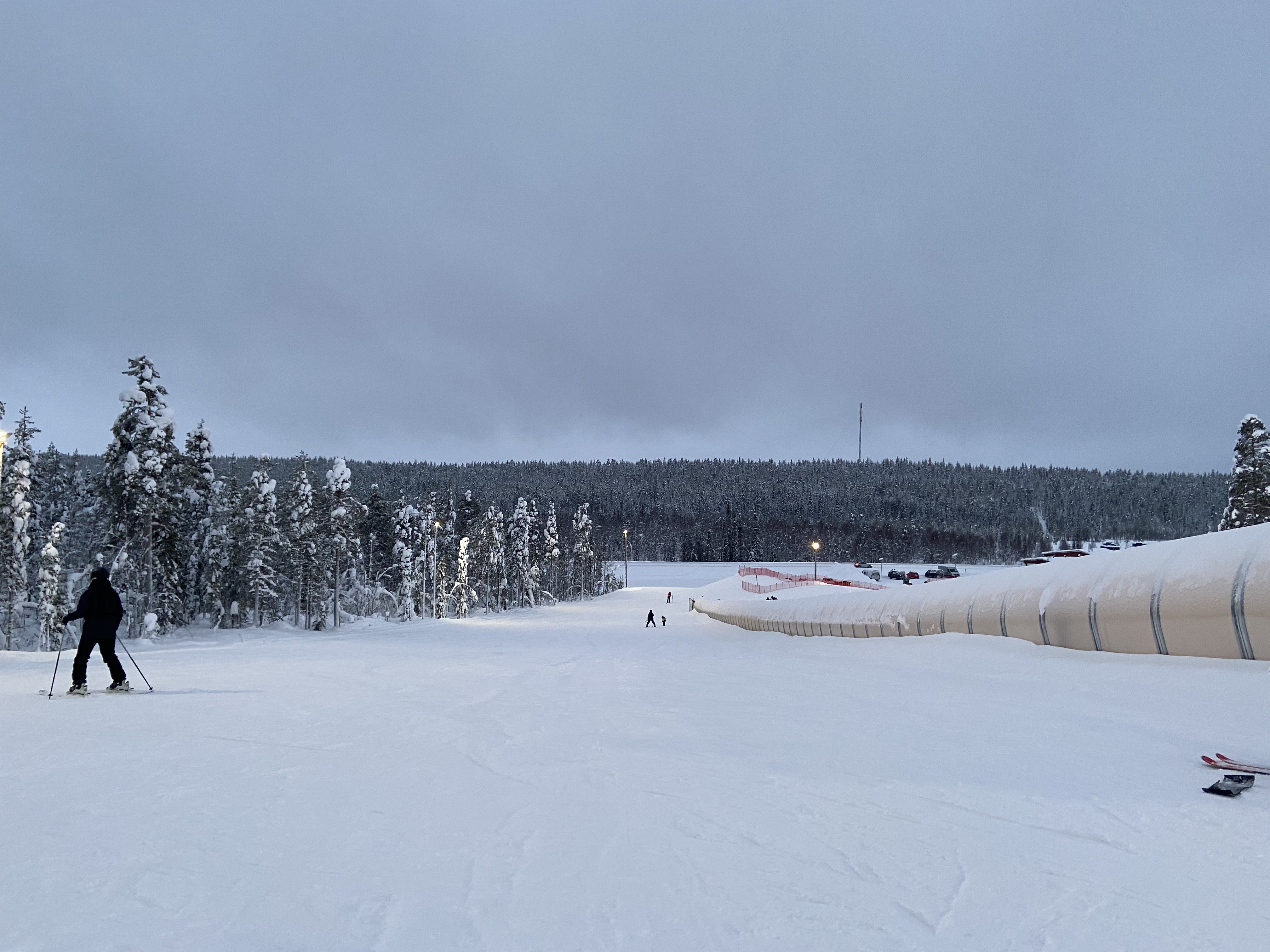 UpcomingLevi World CupThe FIS calendar schedules the women’s and men’s slalom races for 14–15 November in Lapland.
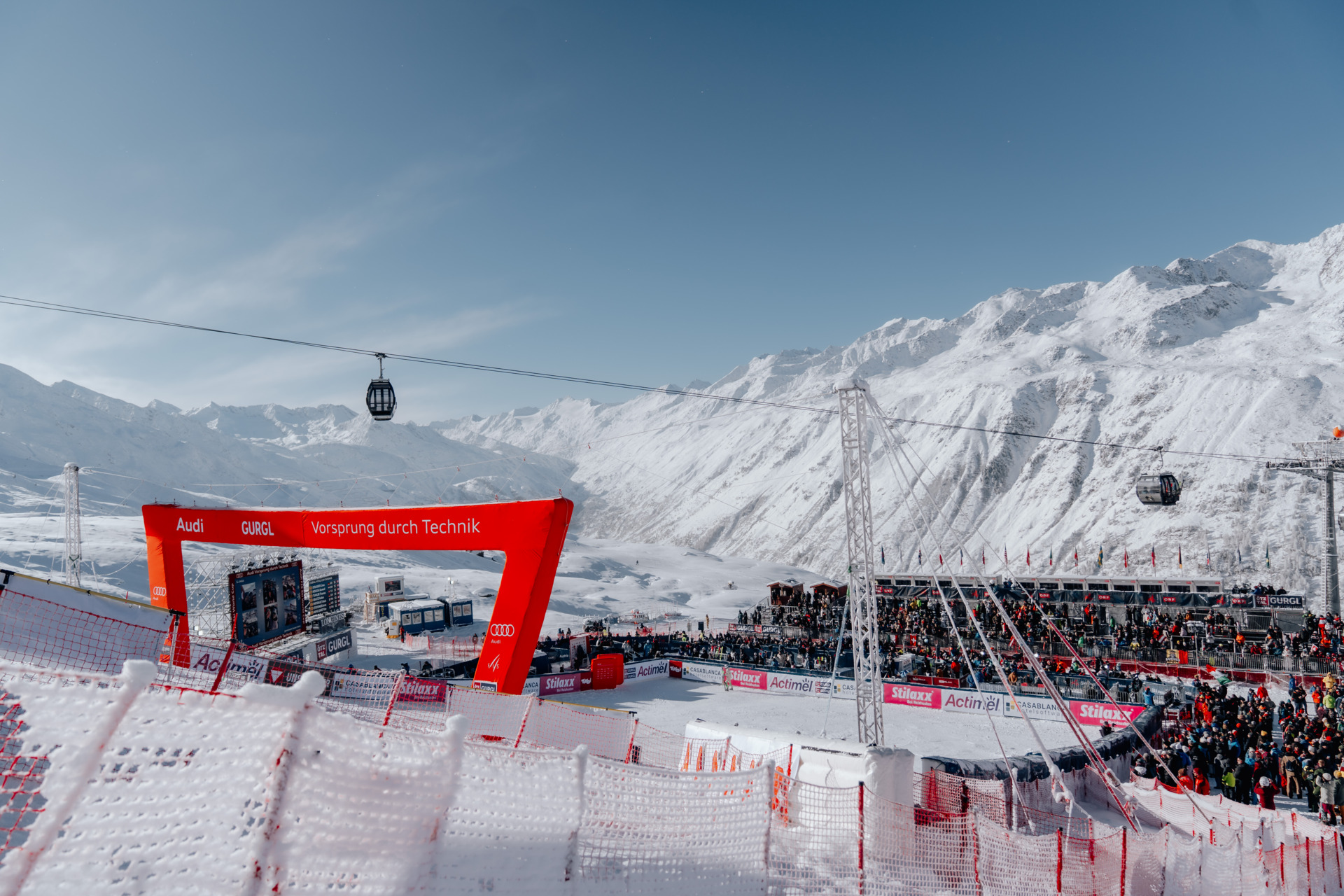 UpcomingGurgl World CupWomen’s and men’s slalom races are scheduled on the Kirchenkar World Cup piste on 21–22 November.
PLACE FR-004 / Belledonne
Three bases, two mountain sides and a return journey to plan: Les 7 Laux links Prapoutel and Pipay above the Grésivaudan with Le Pleynet above the Haut Bréda. Use the independent alpine map and practical guide while checking the day’s open connections, tickets and final return.
 085
MAPS / UNDERSTAND THE AREA
Explore the independent community map and practical starting bases. Read the coverage limits and check current opening and access with the operator.
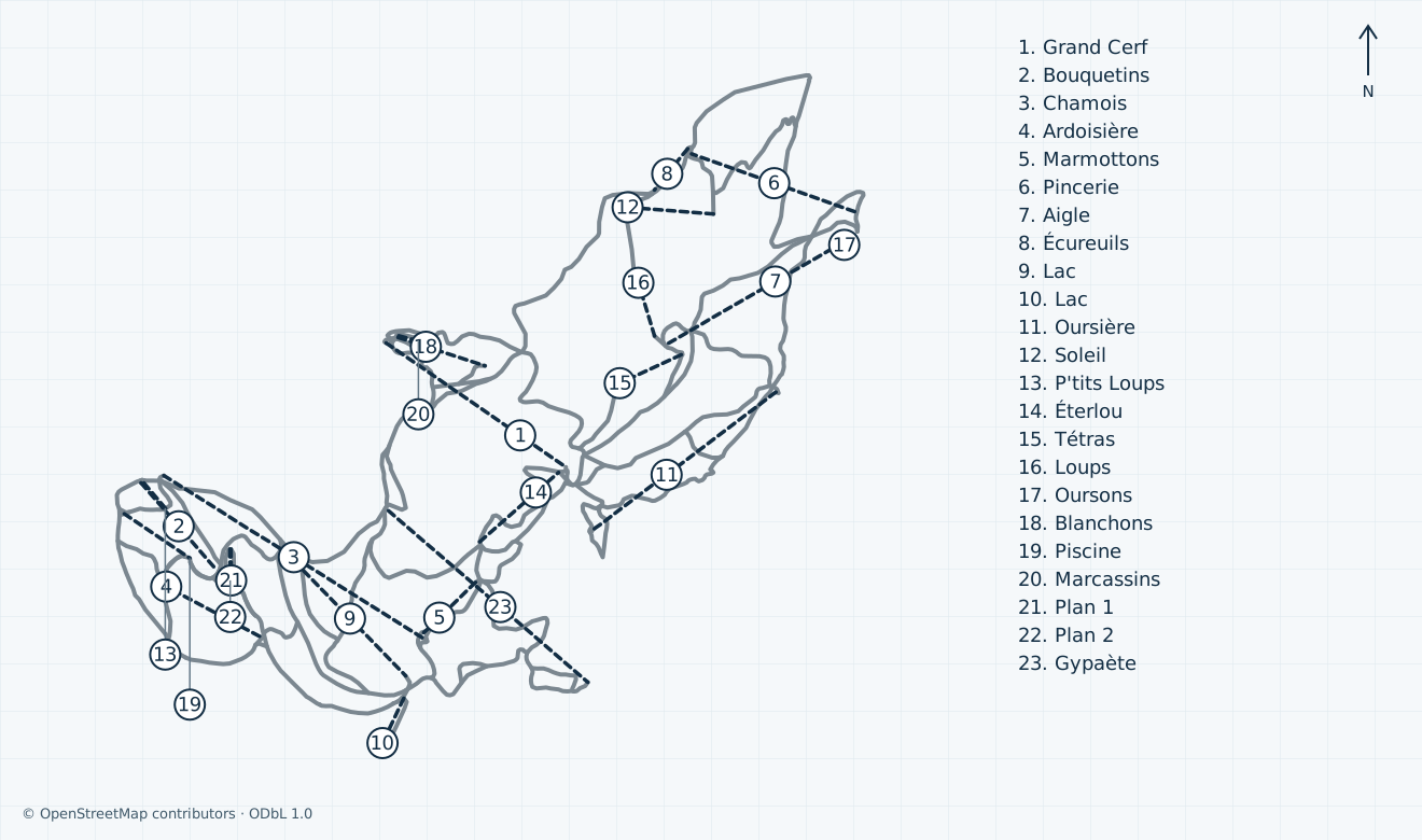
Colours show the published skiing status or confirmed operating calendar, not whether every lift is running. Check the operator before travel.
Confirmed dates change colours automatically in the place’s local time. Tentative dates, conflicting reports and expired checks remain black.
Unconfirmed: a current edition and lawful display basis for the operator’s piste artwork have not been established. That artwork is omitted; this independent community map has not been compared with an inspected operator plan. Scoped community downhill centre lines and passenger alignments cover Prapoutel, Pipay and Le Pleynet. Vallons du Pra, Combe de Bédina, Pas du Chien, backcountry/uncertain ungroomed corridors, abandoned pistes, station outlines and isolated unidentified objects are omitted. Nordic, touring, freeride, extreme, technical, private and proposed features are excluded. Generic grades stay grey; way segments are not an operator inventory. No current opening, access, safe return or navigation is guaranteed. The snapshot clock is the canonical API HTTP response Date, not an Overpass replication timestamp.
HOW THE AREA CONNECTS
Access: Western road base at an advertised 1,350 m, with shops and several separate beginner and mountain lift starts.
Choose the exact lesson or ticket meeting point; a village arrival does not put you at every lift.
Access: Western base at an advertised 1,550 m; the school identifies Grand Cerf as its meeting reference.
A separate road destination from Prapoutel, with its own small-sector and beginner products.
Access: Eastern base at an advertised 1,450 m above the Haut Bréda, approached through Allevard.
Plan its separate road transfer and return; Prapoutel bus information does not establish a Pleynet service.
Prapoutel and Pipay are western Grésivaudan bases; Le Pleynet is on the eastern Haut Bréda side. The school uses Bouquetins, Grand Cerf and Pincerie as respective meeting references. Choose the actual lesson and lift meeting point before reserving transport.
The alpine area spans two mountain sides, with separate lift groups at each base. Ask staff which signed open lifts and descents connect your destination and return at your ability. Unconfirmed: this community map does not establish a currently usable cross-mountain itinerary or a permitted download.
Unconfirmed: current final boarding, each return connection and the full 2026/27 bus journey back to your base are not verified. Get the day’s last-return instructions before ascending, leave time for every connection, and arrange a separate road alternative; autumn lift hours and summer transport material are insufficient.
01 / FIELD OVERVIEW
Independent Les 7 Laux guide to Prapoutel, Pipay and Le Pleynet, with a licensed alpine map, base and return advice, ticket scope and explicit current-operation limits.
Three distinct bases on the Grésivaudan and Haut Bréda sides
Practical connection, ticket and final-return limits
Independent licensed map and genuine 2016 Prapoutel photograph
Prapoutel and Pipay face the Grésivaudan on the western side of Belledonne; Le Pleynet faces the Haut Bréda to the east. The tourist office places their bases at 1,350 m, 1,550 m and 1,450 m respectively. Prapoutel has the broadest advertised village services, while the other two bases have distinct road approaches and meeting points.
The official alpine introduction advertises terrain up to 2,400 m and local green, blue, red and black pistes. Those are local grades: choose a signed open route within your ability, and do not turn a generic community difficulty tag into a French colour. Nordic tracks, touring itineraries, summer biking and freeride terrain are separate activities.
Conflicting sources: the alpine introduction lists 51 pistes, while the detailed status page displays a 53-row headline and separate sector/snowpark groupings. These are unreconciled source inventories, not a measured total here. The independent map’s way segments are not pistes or proof of the operator’s full inventory.
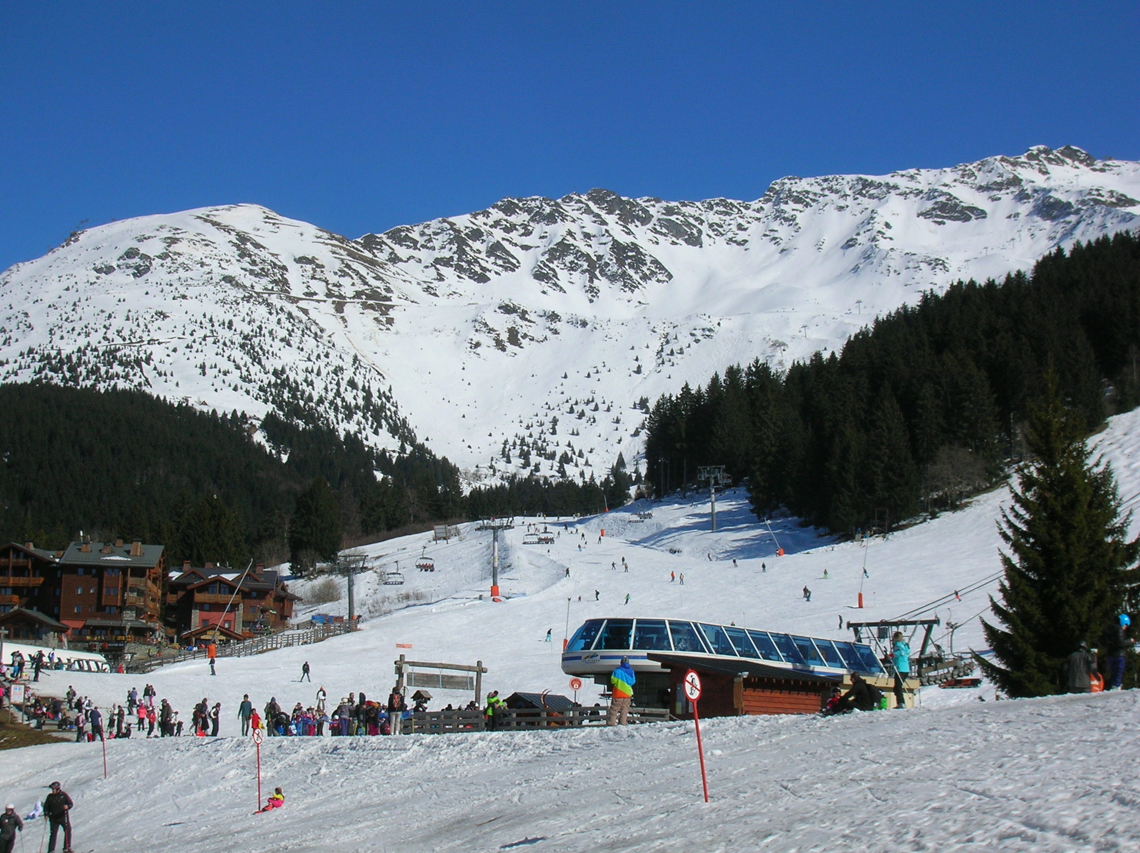
Historical: Patafisik’s genuine 26 March 2016 Prapoutel photograph shows the snowy base, chairlift, visitors and forested mountain. This CC BY-SA 4.0 archive image does not establish today’s snow, lift layout, piste preparation, parking or access.
The official report distinguishes Prapoutel’s Bouquetins, Chamois, Gypaète and Lac chairs from its surface lifts; Pipay has Grand Cerf, Éterlou and beginner lifts, while Le Pleynet has Pincerie, Aigle, Oursière and its own beginner facilities. The community map shows the Grand Cerf mixed passenger alignment and separate Plan lift lines, without claiming a one-to-one official inventory.
The school’s meeting references are Bouquetins at Prapoutel, Grand Cerf at Pipay and Pincerie at Le Pleynet. These are useful base references, not a complete cross-mountain itinerary. Confirm which lifts and signed descents connect your starting side, destination and return at your skiing level before going up.
At the 6 November 2026 source check, the operator’s winter pages said skiing would return soon and all named ski pistes and lifts were closed. Unconfirmed: the announced 19 December 2026–29 March 2027 dates do not guarantee actual opening or every sector’s winter service. Individual winter hours, last boarding, permitted download and every final return connection still need confirmation from staff on the day. The shop’s 31 August–1 November 2026 Bouquetins timetable is autumn operation, not a winter skiing schedule.
The tourist office describes road approaches from the A41/A43 corridor via Brignoud or Goncelin–Le Touvet, depending on the destination. Select Prapoutel, Pipay or Le Pleynet in your route planning rather than treating them as one car park. It explicitly requires winter equipment for the mountain approach; verify current road and parking instructions before departure.
Grenoble is the advertised rail gateway. The tourist office lists winter N94 from Grenoble to Prapoutel, N95/N96 from the valley toward Prapoutel, and N98 from Allevard toward Le Pleynet with a separate valley connection. Confirm the exact origin, destination and both directions with the transport operator.
Unconfirmed: a complete 2026/27 ski-bus timetable, operating dates, fares, exact stops, luggage terms, Pipay transfer and final return were not established. The linked M réso destination page still presents summer material and other destinations; it does not confirm this winter’s Les 7 Laux journeys. Book both directions and arrange any accessible transfer directly.
The shop’s 2026/27 table lists an adult full-day fare of EUR 45 on weekends, school holidays and public holidays, or EUR 42 on other weekdays. A new Keycard is EUR 3, with insurance separate. Consecutive-hour and consecutive-day products differ; confirm the payable date-specific total, eligibility and card compatibility at checkout.
The contract separates the main alpine pass from beginner and small-sector products at each base. Nordic, pedestrian, touring and wider three-domain products have different access. A cheap local beginner pass is not a promise of cross-mountain access; verify every lift you need and keep the personal pass ready for checks.
Conflicting sources: the winter 2026/27 contract still retains a 2025/26 category footnote and older seasonal-compensation dates, while the tariff table’s annual products mention summer 2026 but its explanation says the following summer. Unconfirmed: the applicable annual validity and any compensation must be checked directly; no annual offer or refund entitlement is promised here.
The inspected contract describes consecutive hours from first lift passage and a limited credit procedure for qualifying complete interruptions longer than four hours. Personal circumstances and ordinary weather deterioration have different terms. Read the full applicable contract before purchase and ask about any inconsistent wording.
Wear a helmet, warm up and choose speed and terrain for your ability, visibility and other skiers, following the national sports ministry’s winter advice. Obey the operator’s displayed rules, staff and barriers. A closure net means do not enter; ski only the marked open managed terrain appropriate to your level.
The operator describes freeride areas around Combe de Bédina, Pipay and Vallons du Pra, and warns of their hazards. They are outside this guide’s mapped supported scope, along with backcountry lines and abandoned pistes. Its touring page does not grant general uphill or after-hours access on alpine pistes. Avoid grooming, snowmaking and avalanche-control work; obtain the day’s explicit instructions.
Check rescue, medical transport, liability and repatriation cover before travel. The operator’s insurance page lists the Prapoutel rescue post at +33 4 76 08 01 47. Historical: its displayed rescue-cost examples are explicitly 2025/26, not confirmed current charges. Unconfirmed: today’s response arrangements, costs and any individual assistance should be checked locally.
For lift and ticket questions, the operator’s current contact page lists +33 4 76 08 73 73 and its office at 30 Allée des Terrasses, Prapoutel. Tourist information is separately listed at 40 Allée des Terrasses, +33 4 76 08 17 86. Confirm seasonal opening hours rather than using those contacts as a patrol dispatch service.
Book lessons and rental fitting at the base you will actually reach. ESi PRO 7 lists its Prapoutel office in Les Ayes 3 and different Bouquetins, Grand Cerf and Pincerie meeting references; its current text limits Pleynet starts to private lessons and asks Pipay customers to enquire. The resort directory separately lists medical services, shops and restaurants, while arrival information describes lockers at Prapoutel and Le Pleynet.
Unconfirmed: step-free arrival, adapted equipment, individual boarding assistance, suitable toilets, accessible buses and the complete assisted return are not verified as a continuous journey. Discuss your specific needs with the operator, school and transport provider before booking. A general family or services listing is not an accessibility guarantee.
Selected historical name and local-grade references only. The coverage note explains the unavailable current official plan. This list establishes neither the full inventory nor current opening or access.
04 / AT THE BASE
05 / PROFILE BASIS & SOURCES
This profile is based on current information published or supplied by the place or its operator and the dated sources linked below.
Initial complete ten-scope primary-source review. Announced dates, undated current-status rows, inventory and retained contract conflicts are distinguished; no personal operator confirmation or operator-artwork comparison.
The hero image is an authentic photograph by Patafisik, reused under the CC BY-SA 4.0 license.
Historical: Patafisik’s genuine 26 March 2016 Prapoutel photograph shows the snowy base, chairlift, visitors and forested mountain. This CC BY-SA 4.0 archive image does not establish today’s snow, lift layout, piste preparation, parking or access.
Announced winter dates and tourist information
Three separate bases and valley orientation
Managed alpine scope and attributed local inventory
Individual piste and lift rows; undated status limitations
Winter road equipment and separate advertised transit approaches
2026/27 tariff and product scope
Autumn lift timetable, not winter skiing
Applicable winter contract index
Inspected scanned winter 2026/27 contract and retained older wording
Current lift operator contacts
Exact lesson meeting references and base restrictions
Rescue contact and explicitly older cost examples
Separate touring scope and safety advice
Excluded freeride areas and barrier warning
Resort health-services directory
Artwork display and reproduction terms
Official map landing page; artwork omitted
Transport provider page retaining summer information
Genuine Prapoutel 26 March 2016 photograph and CC BY-SA 4.0
National winter-sports safety advice
Independent community data attribution and ODbL
Community Bouquetins alignment and base planning point