Lower learning basin
Access: Novice tow and Bunny Platter near the mountain base.
Confirm the open learning area, lesson meeting place and pass scope.
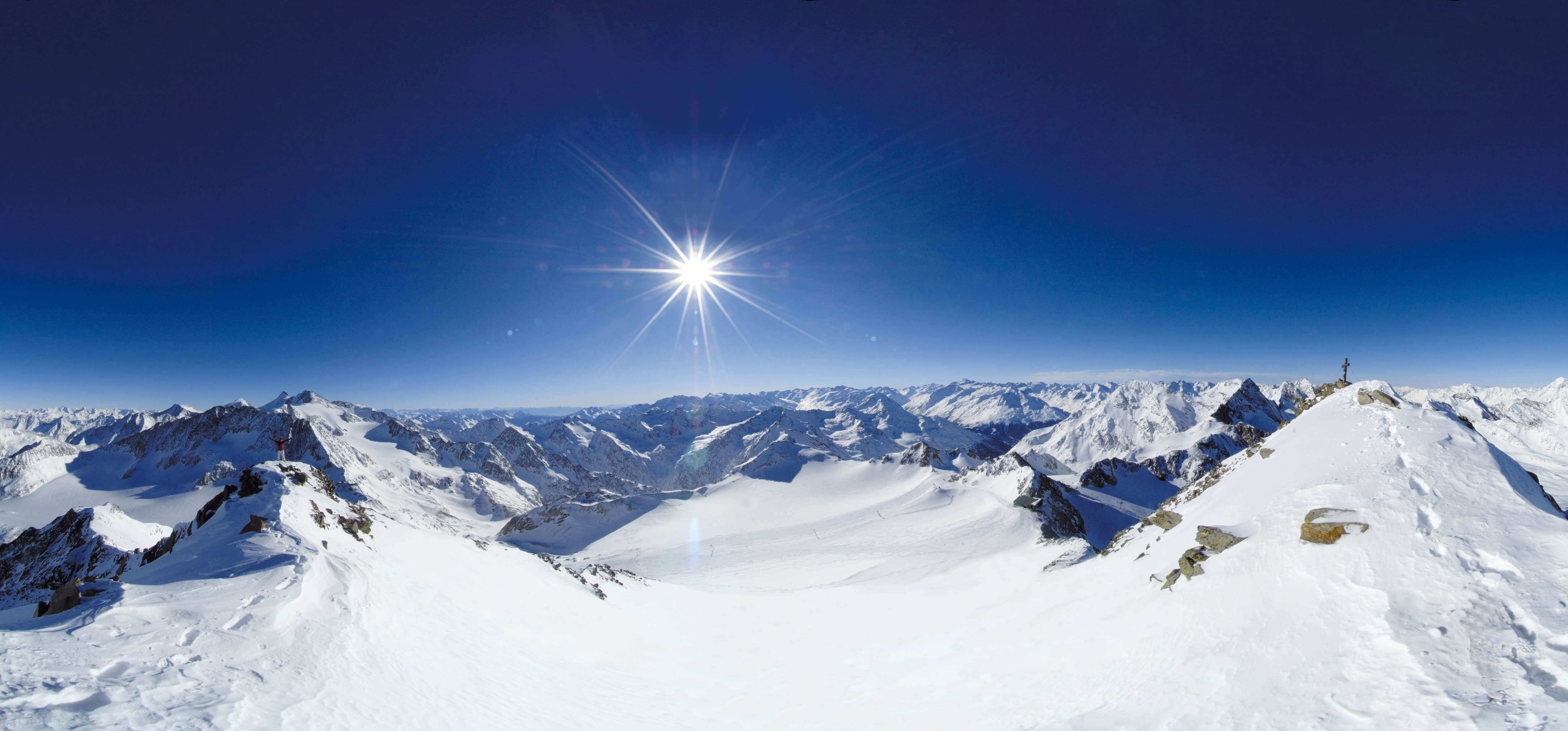 Live nowStubai Zoo Park & Test DaysThe organiser lists Stubai Zoo Park & Test Days for 6–8 November 2026 at Stubai Glacier and in Neustift, Austria. Equipment testing at Eisgrat is scheduled only for Saturday 7 and Sunday 8 November.
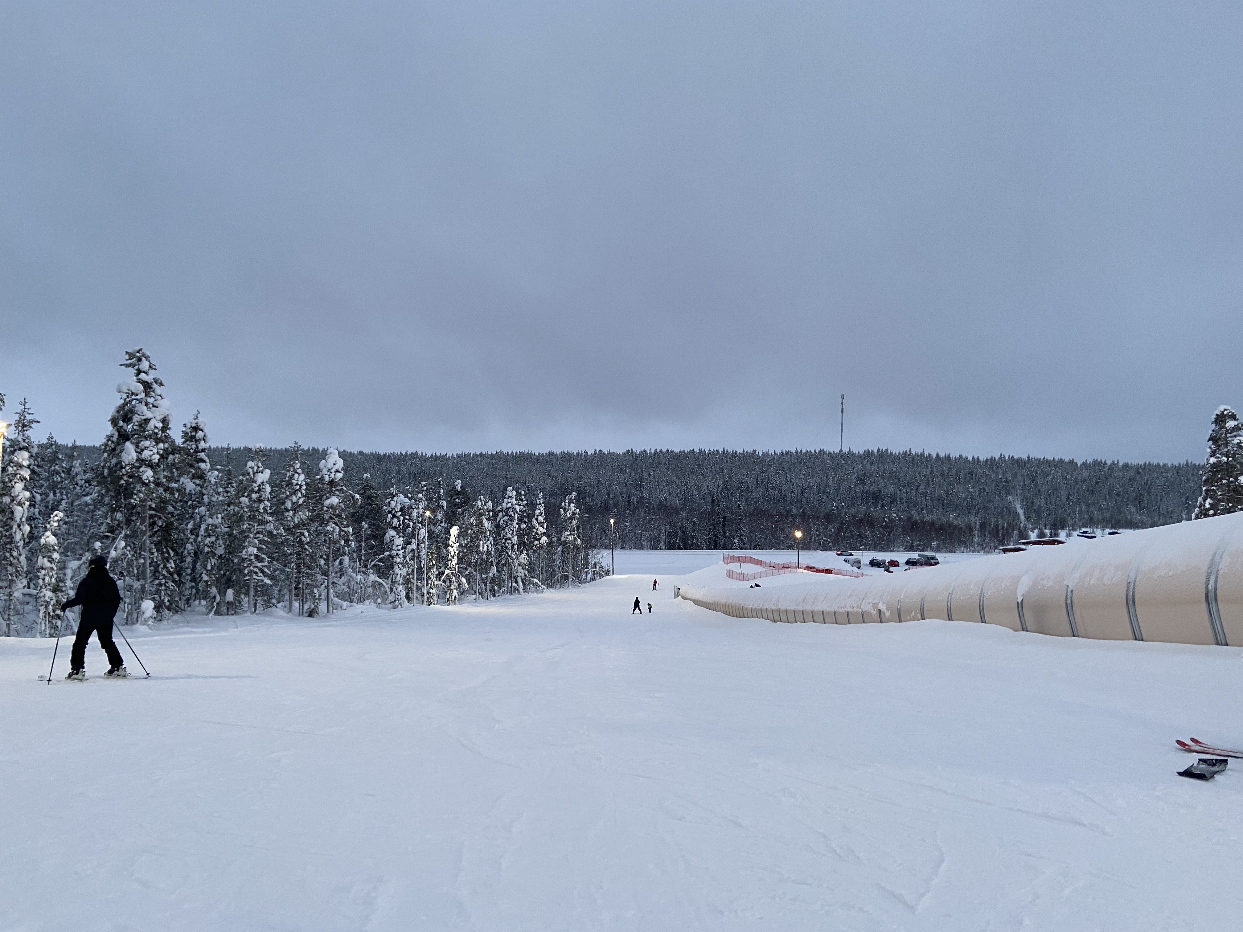 UpcomingLevi World CupThe FIS calendar schedules the women’s and men’s slalom races for 14–15 November in Lapland.
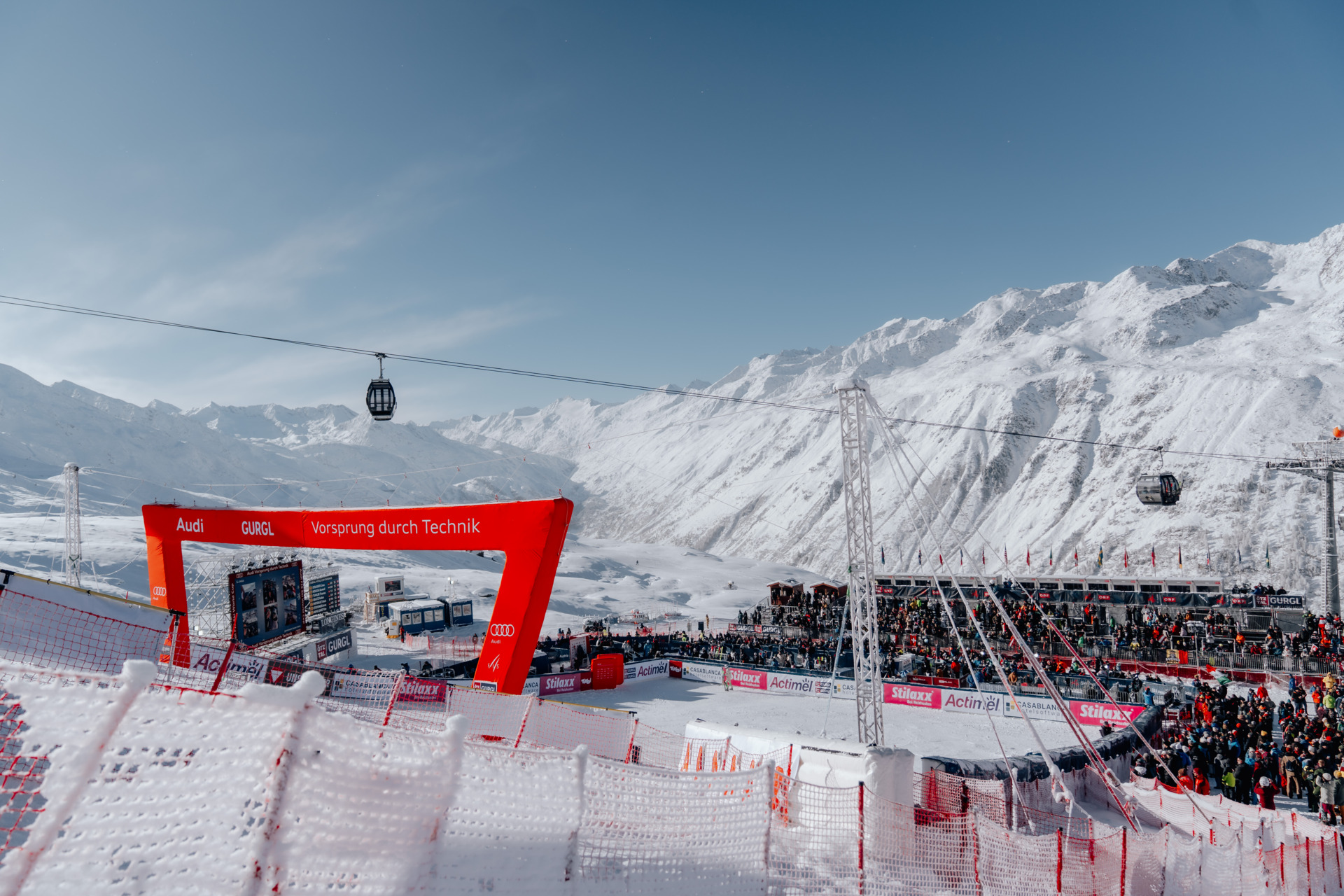 UpcomingGurgl World CupWomen’s and men’s slalom races are scheduled on the Kirchenkar World Cup piste on 21–22 November.
PLACE NZ-003 / Southern Alps / Kā Tiritiri o te Moana
Plan Mt Dobson’s managed Canterbury ski basin with an independent community map, the mountain-road and learner base, sector and return advice, and clear limits on next-season dates, prices and transport.
 097
MAPS / UNDERSTAND THE AREA
Explore the independent community map and practical starting bases. Read the coverage limits and check current opening and access with the operator.
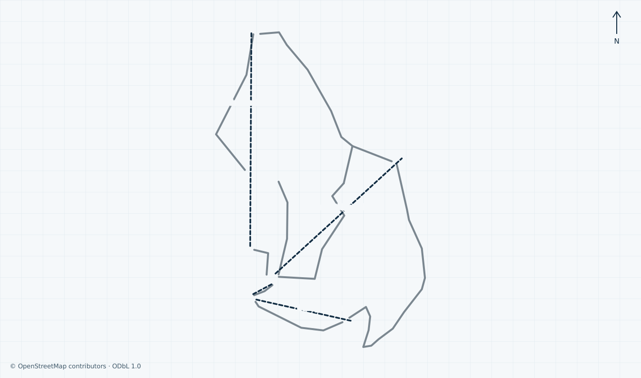
Colours show the published skiing status or confirmed operating calendar, not whether every lift is running. Check the operator before travel.
Confirmed dates change colours automatically in the place’s local time. Tentative dates, conflicting reports and expired checks remain black.
Unconfirmed: the operator map page is linked separately, but a current artwork edition and lawful inline preview have not been verified; no operator artwork is reproduced in this guide. The independent ODbL map covers inspected community downhill and passenger-lift alignments in the managed Mt Dobson basin. Specialist Half Pipe and FIS Course ways are excluded; summit hikes, backcountry, private and technical objects are outside scope. Community names and generic difficulties are not verified local names or grades, so piste lines remain grey. Mapped segments are not the operator’s trail inventory and prove no opening, grooming, access or safe return. The snapshot time is the canonical OSM API HTTP response Date, not an Overpass replication timestamp.
HOW THE AREA CONNECTS
Access: Novice tow and Bunny Platter near the mountain base.
Confirm the open learning area, lesson meeting place and pass scope.
Access: Published T-bar sector above guest services.
Check a signed suitable connection and descent.
Access: Community-mapped chair alignment; operator lists Opuha Saddle triple chair.
Confirm actual boarding, terrain and final return.
The 15 km access road reaches parking beside the lifts. The operator places guest services near the Fairlie Ridge T-bar, with toilets on the way. Check ticket scope, rental fitting and the actual open learning area before boarding. The community location pin is not a verified accessible entrance.
The independent community geometry separates the lower learning area, Fairlie Ridge surface lift and northern chair sector. Ask staff for the signed open connection and an appropriate descent before moving between them. Community trail labels are unverified against the current operator inventory; this map does not establish patrol limits or access.
Unconfirmed: individual last boarding, passenger download, the final road-gate time and a dated future shuttle are not established. Before ascending, confirm a suitable signed return, equipment hand-back and your complete ride down. The FAQ’s retained 16:10 shuttle collection is not a confirmed future booking.
01 / FIELD OVERVIEW
Independent Mt Dobson ski guide with licensed community geometry, genuine historical photography and practical road, lift, ticket, safety and return advice.
Mountain-road and learner-base orientation
Platter, ridge and chair sectors
Independent scoped community map
Mt Dobson is a commercial alpine ski and snowboard field above Fairlie in Canterbury, on New Zealand’s South Island. This guide covers the managed lift basin, with its lower novice area, Bunny Platter, Fairlie Ridge surface lift and northern chairlift sector. It does not describe a summit ascent, touring route or off-piste itinerary.
The operator advertises more than 400 acres and more than 14 trails, with local green beginner, blue intermediate and black advanced categories. Those are the operator’s published categories, not universal grades. Ask staff which signed open terrain suits your ability before leaving the learning area.
Unconfirmed: a current match between community trail names, operator names and local grades has not been established. The independent map keeps the inspected basin alignments grey and omits specialist Half Pipe and FIS Course ways. Mapped segments are not an official trail inventory, a patrol boundary or evidence of open terrain; summit hikes and steep off-piste terrain are outside this guide.
The published managed-lift list comprises a novice tow, Bunny Platter, Fairlie Ridge T-bar and Opuha Saddle triple chairlift. The FAQ describes the road normally opening at 08:00, the first lift at 09:00 and the chairlift at 10:00. These are normal-day planning references, subject to snow, weather and staff instructions; they do not establish operation today.
Historical: the operator’s linked live report was last updated on 20 September 2026 at 18:22 and announces closure for the 2026 season. It lists the road, all four lifts and visitor facilities closed. The homepage still carries a Winter 2025/28 June banner; that banner is also historical and must not be read as a future opening announcement.
Unconfirmed: current skiing, exact next-season dates, individual last boarding, passenger download and the final safe return are not established by these retained pages. Check the actual daily road and lift report before departure and confirm a signed descent suitable for your group before boarding. Do not infer a 2027 season from the FAQ’s generic July-to-September description.
The operator’s arrival page places the turn from State Highway 8 between Fairlie and Lake Tekapo, followed by a 15 km gravel mountain road to parking beside the ski lifts. Use the signed roadside parking area rather than stopping on the highway. The first seven kilometres cross working farms: drive slowly, respect livestock and keep space for emergency and road-maintenance vehicles.
Carry correctly fitting snow chains in every vehicle and practise fitting them before travelling. Follow the day’s road signs and chain-fitting instructions, including for four-wheel-drive vehicles with road tyres. The operator identifies icy shaded corners, steep grades and avalanche no-stopping zones. Reduce speed to conditions; a mapped road or an open scenic attraction is not permission to drive through a closure.
Conflicting sources: one FAQ answer advertises an eight-seat weekend and school-holiday shuttle, while another says Mt Dobson does not operate a shuttle. The same page describes the highway pickup both seven kilometres out of Fairlie and the road junction eleven kilometres west. Do not rely on either location or service without confirmation.
Unconfirmed: the next season’s shuttle dates, fares, pickup, booking availability and complete return are not verified. The retained FAQ lists Fairlie pickup at 08:00 and collection at ticketing at 16:10, but these are not a dated future timetable. Confirm the exact meeting point, equipment return and your own ride down before travelling; accessible parking and step-free boarding also require individual confirmation.
Historical: the passes page explicitly labels its day and rental tables for the 2026 season, with age taken on 1 June 2026. It lists an adult all-lift day at NZ$124, an afternoon after 12:30 at NZ$92, a learner-platter day at NZ$86 and an adult rope-tow product at NZ$19. These distinguish access products; they are not next-season offers.
The published categories separate adult, full-time tertiary student with identification, youth and child. Rental equipment, lessons, learner packages and season passes have their own prices and scope. The terms state that prices are in New Zealand dollars including GST, passes are personal and weather can change both season length and available terrain.
Unconfirmed: next-season prices, product validity, lesson and rental inclusions, and current refund or transfer eligibility have not been verified. Obtain a complete quote for your age, ability, date and required lifts. A season product still visible in the shop does not establish a ski-opening date, current availability or entitlement to every area.
The operator’s Snow Code requires controlled speed, priority for people downhill, compliance with every closure and a visible stopping place. Secure equipment and remain at an accident to identify yourself to Ski Patrol. Southern Alps weather can change quickly; carry suitable layers, eye and sun protection, and ask staff about the day’s hazards before ascending.
The operator recommends a helmet for everybody skiing or snowboarding. This managed-area guide grants no uphill, backcountry, private-station or summit access. A separate operator hiking notice says neighbouring stations have no automatic entry right and warns that terrain beyond the concession is outside its support. Those specialist routes, single-ride products and steep off-piste suggestions are omitted from the map and itinerary.
Unconfirmed: the actual day’s patrol contact, rescue coverage, accessible evacuation, last lift and road-gate closure are not established. Ask guest services before boarding and agree a return plan with your group. The official contact page lists +64 3 281 5509 for the office and 027 685 8039 as an after-hours operations contact; neither is presented here as an always-staffed piste emergency line. Do not use this map for emergency navigation.
Ticketing and guest services are described in the main mountain car park beside the Fairlie Ridge T-bar, with toilets on the approach. The Foote Hills rental shop lists ski and snowboard equipment, boots, poles, helmets and limited clothing. Bring your own gloves and goggles; the operator says helmets are included when renting skis or snowboards. Confirm sizes, fitting, collection and return rather than treating advertised stock as a reservation.
The snowsports school offers individual and same-ability small-group instruction. Its private-lesson page asks for enquiries at least 48 hours ahead and arrival an hour before the lesson for check-in and equipment. The Foote Rest Café is the published food and drink base. Contact the office on +64 3 281 5509; the FAQ also gives gs1@mtdobson.co.nz for lesson enquiries.
Conflicting sources: the FAQ lists private lessons at 10:00, 12:00 and 14:00; the private-lesson page gives 10:00, 12:30 and 14:30, while its form offers 14:00. Confirm the actual booked time and meeting place directly.
Unconfirmed: next-season lesson and rental prices, facility opening, accessible toilets, adaptive equipment, boarding support and the complete individual return chain are not verified. The postal and freight addresses on the contact page are in Fairlie, not the mountain meeting point. Family-friendly wording and roadside parking do not establish step-free access.
Selected historical name and local-grade references only. The coverage note explains the unavailable current official plan. This list establishes neither the full inventory nor current opening or access.
04 / AT THE BASE
05 / PROFILE BASIS & SOURCES
This profile is based on current information published or supplied by the place or its operator and the dated sources linked below.
Initial actual ten-scope independent source review covers managed terrain, retained season report, normal hours, road, prices, safety and services; map and image clocks remain independent.
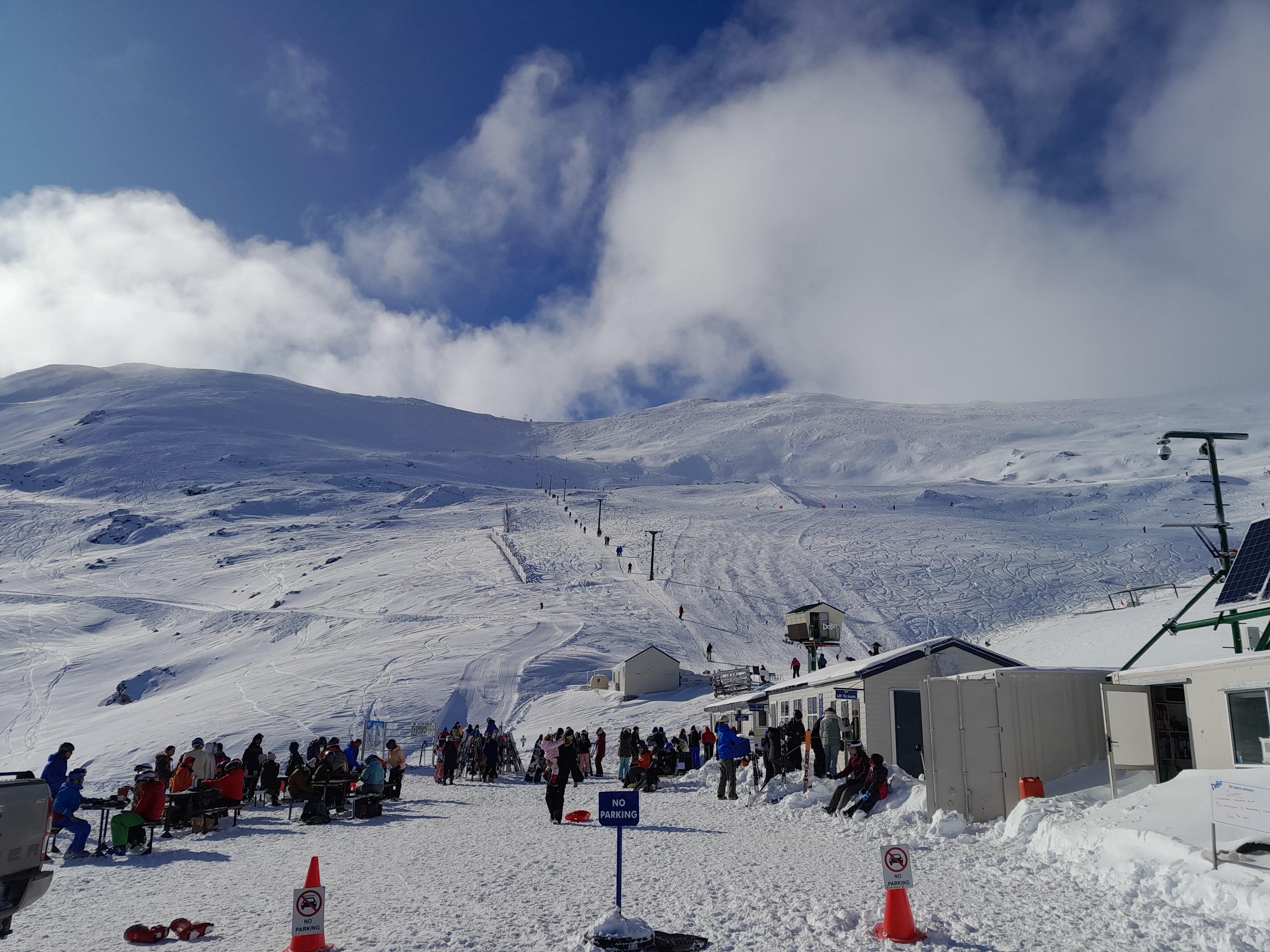
The hero image is an authentic photograph by Wildman NZ, reused under the CC BY-SA 4.0 license.
Historical: Wildman NZ’s genuine 14 July 2022 photograph shows the mountain base, guests and snowy lift basin. It establishes no current snow, operating lift, open road or safe route.
Exact source scope and limitations in the corresponding practical guide section.
Exact source scope and limitations in the corresponding practical guide section.
Exact source scope and limitations in the corresponding practical guide section.
Exact source scope and limitations in the corresponding practical guide section.
Exact source scope and limitations in the corresponding practical guide section.
Exact source scope and limitations in the corresponding practical guide section.
Exact source scope and limitations in the corresponding practical guide section.
Exact source scope and limitations in the corresponding practical guide section.
Exact source scope and limitations in the corresponding practical guide section.
Exact source scope and limitations in the corresponding practical guide section.
Exact source scope and limitations in the corresponding practical guide section.
Exact source scope and limitations in the corresponding practical guide section.
Exact source scope and limitations in the corresponding practical guide section.
Exact source scope and limitations in the corresponding practical guide section.
Exact source scope and limitations in the corresponding practical guide section.
ODbL community geometry, attribution and accessible derived data.
Historical image date, original creator and CC BY-SA 4.0 grant.