Choose Poljice, Ogorjelica or the lower Skočine/Prača base before setting out. The connected alpine slopes have different returns, local grades and ticket scopes.
Jahorina / Pale, JahorinaPoljice, Jahorina, Bosnia and Herzegovina
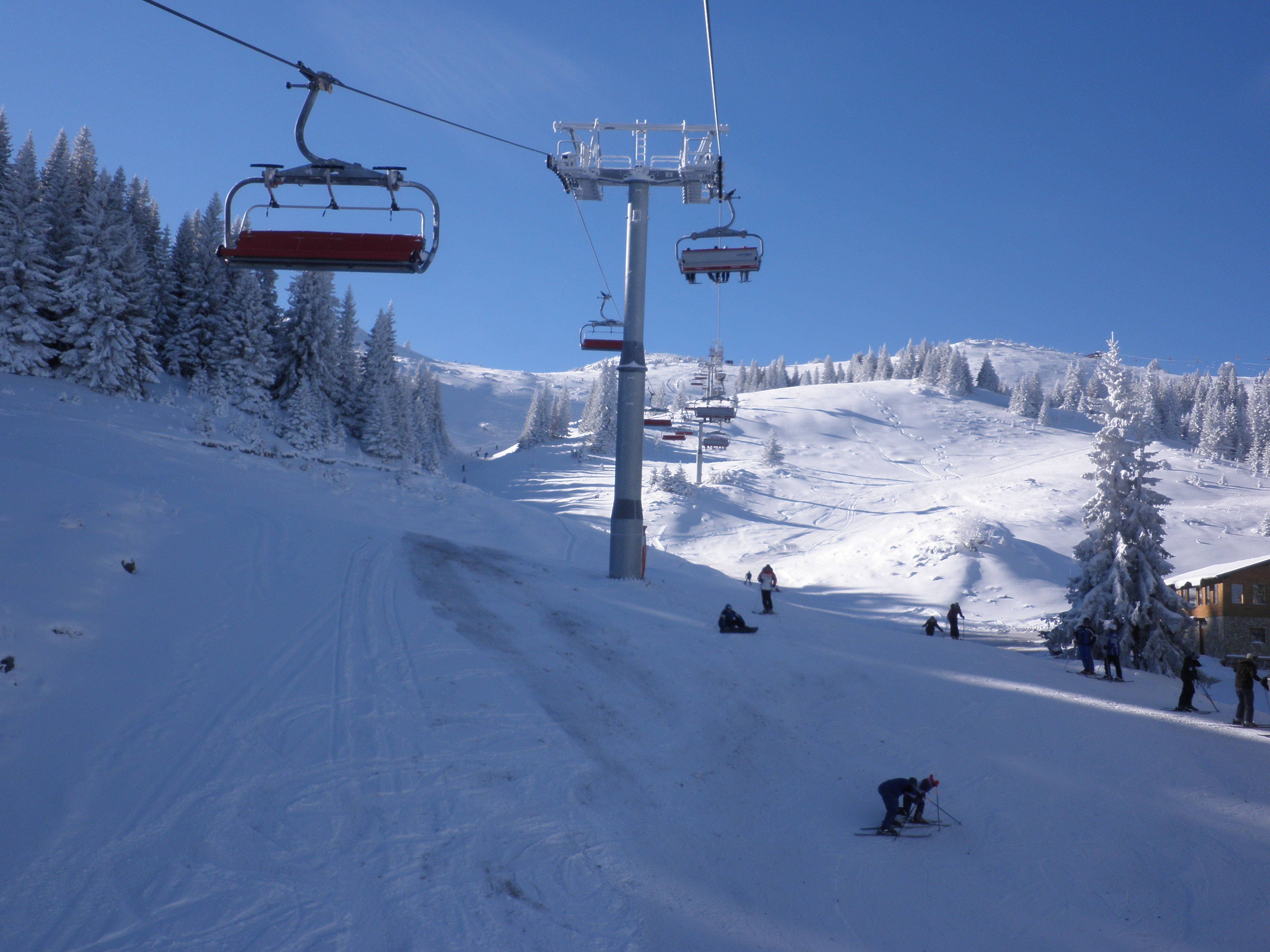
AUTHENTIC OPEN-LICENSE PHOTOPhoto: nikola_pu / Wikimedia Commons / Panoramio archive · CC BY-SA 3.0Jahorina–Ogorjelica, 4 January 2011 archive. nikola_pu · CC BY-SA 3.0 · Display crop.
SKI AREA LAYOUTAlpine network with separate learning areas; Nordic, touring and summer attractions have other scopes
UPLIFTPoljice and Partizan gondolas, chairlifts and surface lifts; school installations have a separate scope.
LOCAL DIFFICULTYLiteral blue, red and black source references; conflicting 2023 rule wording and mixed 6b require current local confirmation. Own map omits disputed upper geometry.
SKIING CHARACTERAlpine / Snowboard
MAPS / UNDERSTAND THE AREA
See how the mountain connects.
Explore mapped pistes and lifts, compare the official plans and choose the right starting base. Check current opening separately.
↑ N
Open for skiing
Closed today · opening within 14 days
Closed for skiing
Unknown / uncertain
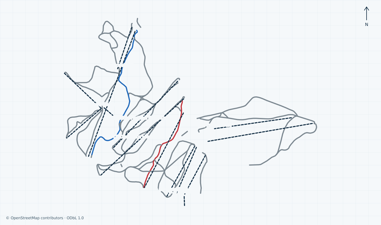
Colours show the published skiing status or confirmed operating calendar, not whether every lift is running. Check the operator before travel.
Confirmed dates change colours automatically in the place’s local time. Tentative dates, conflicting reports and expired checks remain black.
Jahorina alpine network across Poljice, Partizan/Novak Đoković, Ogorjelica, Rajska/Olimpik/Javor, Trnovo and Skočine/Prača, with fourteen numbered passenger ways. Area polygons, abandoned/disused ways and unconfirmed school conveyors are omitted. Black 5 and unresolved upper Olimpik/Skočine branches are also omitted conservatively because the map and resort-use rules describe black categories differently; the map is incomplete at those connections. The official 6b reference changes from black to red and must not be treated as one grade. Only exact selected names 1 and 3 receive their literal operator-map colours; unmatched geometry stays grey. Nordic, touring, backcountry and summer attractions are outside this scope. Community segments are not an operator inventory, live opening report or navigation.
Access: The Poljice gondola, ticket collection and depot form a main starting base. Trnovo and its learning area sit along a different approach.
Blue and red branches have distinct identities; match the precise lesson, rental and return before choosing a drop-off.
02
Partizan / Novak Đoković and Ogorjelica
Access: The Partizan gondola and Ogorjelica chairs have separate lower stations connected by marked piste branches.
A connection on the plan does not establish an open route or easy return; check local signs and the individual lift status.
03
Rajska, Olimpik and Javor
Access: Upper and central lifts serve red and black branches, with connecting routes to other sectors.
Choose a branch suited to your ability. Do not assume the lower colour describes a complete descent from the ridge.
04
Skočine / Prača
Access: A lower eastern base with the Skočine chair and separate Prača surface lift is shown on the official original.
The mapped 6b route changes from black to red. Check the last working return link before committing to this lower base.
01
Choose the exact starting base
Poljice gondola, Ogorjelica chairs and Skočine/Prača have different lower stations and parking approaches. Match the lesson or rental meeting point before selecting a drop-off. The marker is an approximate Poljice station reference; a parking symbol does not verify capacity or step-free access.
02
Check the connecting branch before changing sector
The official original links Poljice and Partizan with Ogorjelica and the central Rajska/Olimpik terrain through individually numbered branches. Blue, red and black choices differ. Use the actual operating report and local signs; a line on either map is not permission to use a closed connection. Our community map omits disputed upper branches; use the official original for their source context and ask staff about a suitable open return.
03
Plan the return from Skočine/Prača
The lower Skočine/Prača base is separate from Poljice. The published table gives Skočine an earlier 15:45 finish than most 16:00 rows, while Poljice has a 15:00 listing in the old report. Confirm current last boarding and onward transport before descending; the upper 6b branch is black and its lower section red on the source map.
A map-first planning guide to Jahorina, its alpine bases, sector connections, marked piste grades and practical winter arrangements.
Distinct Poljice, Ogorjelica and Skočine/Prača starting choices
2026/27 ski-pass tariff with separate day, night and learning-area products
Official map retained as an external original; community geometry is not current operation
Read the marked branches and keep inventory scopes separate
Jahorina is an alpine network above Pale in the Dinaric Alps, with Poljice, Partizan, Ogorjelica, Rajska/Olimpik, Trnovo and lower Skočine/Prača starting or connecting areas. This guide excludes Nordic trails, independent touring and summer attractions. The operator advertises 54 km and 18 transport installations; these are marketing inventory scopes, not a count established from community map segments.
The actual original linked by the map page has a December 2024 filename. Its numbered lift key has 14 entries, while the operating page lists learning areas separately. An older operator inventory still describes about 35 km and superseded installations. Preserve these different editions rather than combine them into a current audited total.
The map key calls blue easy, red medium and black difficult. The September 2023 resort-use regulation instead describes green easy, blue medium, red difficult and black extremely difficult. Selected references 1, 3 and 5 retain their literal map colours without reconciling that discrepancy by invention. The 6b branch itself changes from black to red; ask staff about the exact signed route before setting out. Our community map conservatively omits black 5 and unresolved upper Olimpik/Skočine geometry under that uncertainty; it cannot establish a complete connection there. The optional black 5 name is a literal source reference only.
Distinguish announced dates from daily lift operation
The operating list identifies Poljice and Partizan gondolas, the Ogorjelica, Skočine, Rajska and Trnovo chairs, and the named surface lifts. Its last displayed update is 27 September 2026 and its piste and four learning-area rows are closed. Several lift status symbols are not expressed in the text extraction. Neither the generic home counter nor the old timetable proves skiing is available today.
The 2026/27 tariff page labels 6 December 2026 as the opening date. This is a planning reference, not a guarantee that every lift or piste will open then. The operator confirms the previous winter ended on 19 April 2026. No exact final public ski day for 2026/27 was verified.
The retained report gives Poljice 09:00–15:00, Skočine 09:00–15:45 and most other listed daytime installations 09:00–16:00. The general night-skiing page describes 18:00–21:00 and named illuminated sectors. Confirm the actual date, last boarding and return lifts separately; neither old daytime rows nor a lit line establishes an available evening session.
Choose a base and arrange the complete return journey
The operator location page places Jahorina about 28 km from Sarajevo and 12 km from Pale. The map marks different parking and ticket areas beside Poljice, Ogorjelica and Skočine/Prača. Pick the exact lesson and equipment collection point before choosing a road destination. The approximate Poljice marker is not a surveyed vehicle entrance or a confirmed accessible route.
The detailed parking notice explicitly concerns winter 2025/26: it names Poljice/Lane at BAM 20 per day and other listed areas at BAM 15, with different multi-day and season restrictions. Those are historical planning figures, not accepted 2026/27 tariffs. Confirm current charges, overnight rules, capacity and the walk from the chosen space before travel.
No complete dated 2026/27 public transport chain was established. The carrier source found for a free Jahorina bus concerns only 8 February 2024; it must not be promoted as a current service. Check the actual carrier for the chosen date, departure stop, skis, last return and boarding assistance. Arrange individual transfers and accessible approaches explicitly; a short advertised distance does not verify a step-free journey. The operator transport destination also returned 404 on recheck; the carrier journey page loaded but supplied no accepted forthcoming Jahorina itinerary.
Select the exact day, night and learning-area product
The actual 2026/27 individual BAM tariff gives a full-price adult day at 98, four hours at 80, night skiing at 80 and day-plus-night at 150. These are distinct products. The informational calculator showed 98 BAM for one adult day on 28 December 2026, 78 BAM on 6 December and 69 BAM on 10 March 2027. It rounds displayed discounted amounts; the webshop remains the final purchase authority.
The printed categories place children from six to before fourteen and seniors from sixty-five; teenagers from fourteen to before nineteen share a category with seniors even though the adult wording also begins at fourteen. Confirm the applicable category at purchase. Under-six skiing with one adult is free outside the learning areas. Ordinary ski passes do not cover the ski kindergarten, and sightseeing gondola tickets are for travel without ski equipment.
Passes of four days or longer require a photo, and two-to-seven-day products run consecutively. The September–October presale ended on 20 October and is not a current offer. The tariff calculator is informational: verify the exact start date, card charge, collection, identification and cancellation or closure conditions in the selected webshop product. No transaction or accepted final checkout price was obtained.
Follow closures, lift staff and the exact local signs
The consolidated September 2023 rules close terrain when weather, avalanche danger, insufficient snow, machinery or missing safety cover prevent safe use. They require controlled speed, respect for skiers below, obedience to signs and staff, and skiing only on marked authorised terrain. The provision about walking at the piste edge is not permission for unrestricted ski touring or access during closure.
The February 2026 chairlift notice requires careful boarding, immediate safety-bar closure and an adult beside a child, with no moving children between seats or using a phone during boarding and travel. A separate February 2022 operator safety notice requires helmets for children under fifteen and recommends them for adults. Confirm the current rules and individual suitability with staff before use.
The official contact and map give mountain rescue at +387 66 636 636. Explain the exact piste reference, lift or nearby signed point when seeking help. Do not infer an assessed avalanche level or a permitted off-piste route from the map. Mixed 6b grades, outdated status hours and the regulation/map category difference make the exact signed return particularly important.
Confirm lessons, rental and assisted access for the chosen station
The operator describes a ski and snowboard school and marks teaching areas, rental points, ticket offices, restaurants and rescue facilities on the plan. This establishes service types rather than a current appointment, rental stock or winter opening. Both the current school destination and the native school URL returned 404 on recheck; indexed results and an expired December 2025 promotion are not accepted current lesson information. Confirm a working lesson contact with the operator sales office; no current lesson price was verified.
The depot page describes storage inside the Poljice gondola base: one unit holds two equipment sets, with a stated BAM 15 daily depot charge and BAM 10 deposit for a new access card. Confirm availability, date, collection and return at the marked Poljice ticket office; this is a storage service, not a ski-rental package.
The published main office is +387 57 270 090 and sales is +387 57 270 003. Ask about the exact meeting point, equipment, permitted lift descent and individual boarding support. No complete verified step-free chain between parking or bus, ticket collection, toilets, lesson and lift was established. Arrange those elements in advance rather than treating a gondola symbol as an accessibility guarantee.
Selected source-checked references only. Use the complete official plan for the network; this list is not the resort’s total piste count or live opening report.
Blue on the map; map key calls it easy1PoljiceRed on the map; map key calls it medium3OgorjelicaBlack on the map; map key calls it difficult5Olimpik
04 / AT THE BASE
Facilities that change the day.
Separate ski-learning areas Operator-described ski and snowboard school Equipment depots at the Poljice gondola Ticket offices and mountain rescue contact
05 / PROFILE BASIS & SOURCES
What this profile is based on.
This profile is based on current information published or supplied by the place or its operator and the dated sources linked below.
SOURCE CHECKED
Complete source review across all ten scopes, with explicit old status/transport editions, unknown current service details and the map/regulation wording discrepancy. Disputed upper geometry is conservatively omitted; no universal grade conversion or current operation inferred.
AUTHENTIC OPEN-LICENSE PHOTO · 2026-10-29
The hero image is an authentic photograph by nikola_pu, reused under the CC BY-SA 3.0 license.
Genuine 3968 × 2976 original preserved without retouching. Archive photograph, not current snow, lift configuration or an entrance. CSS crops only.