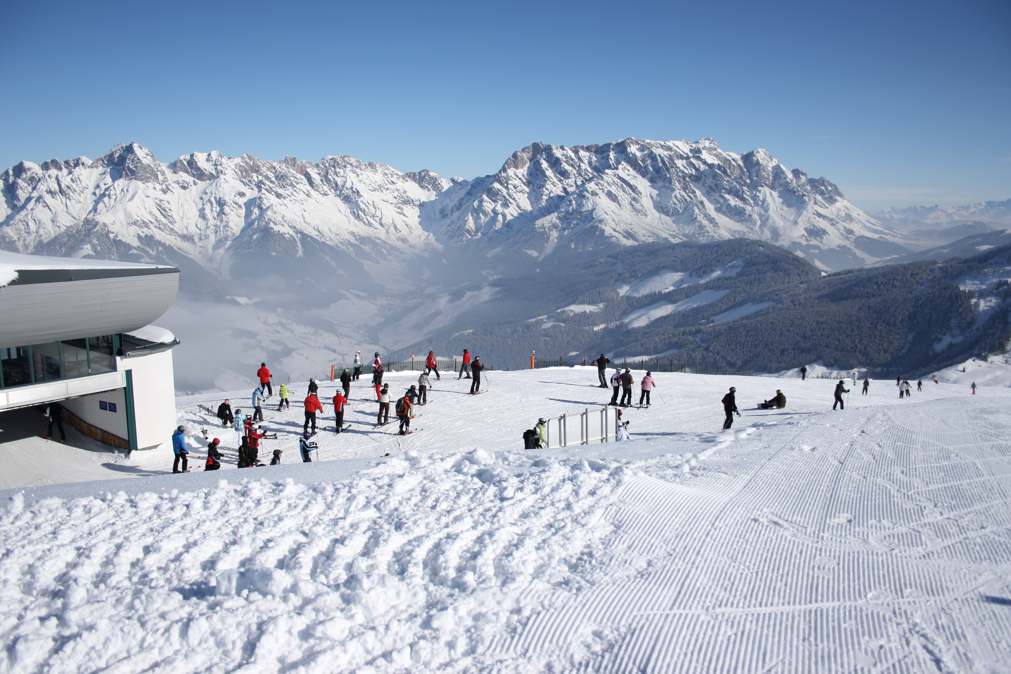
AUTHENTIC OPEN-LICENSE PHOTOPhoto: Patrick-Emil Zörner (Paddy) / Wikimedia Commons · CC BY-SA 3.0Historical: Aberg, 14 February 2010 · Patrick-Emil Zörner · CC BY-SA 3.0.
SKI AREA LAYOUTManaged linked downhill terrain across three villages; separate Hochkeil and Hinterreit are excluded from this map.
UPLIFTOperator-listed gondolas, chairlifts and surface lifts connect distinct village sectors; seasonal and return conditions differ.
LOCAL DIFFICULTYLocal easy, intermediate and difficult piste labels; the Königstour requires red-piste skiing ability.
SKIING CHARACTERAlpine / Snowboard
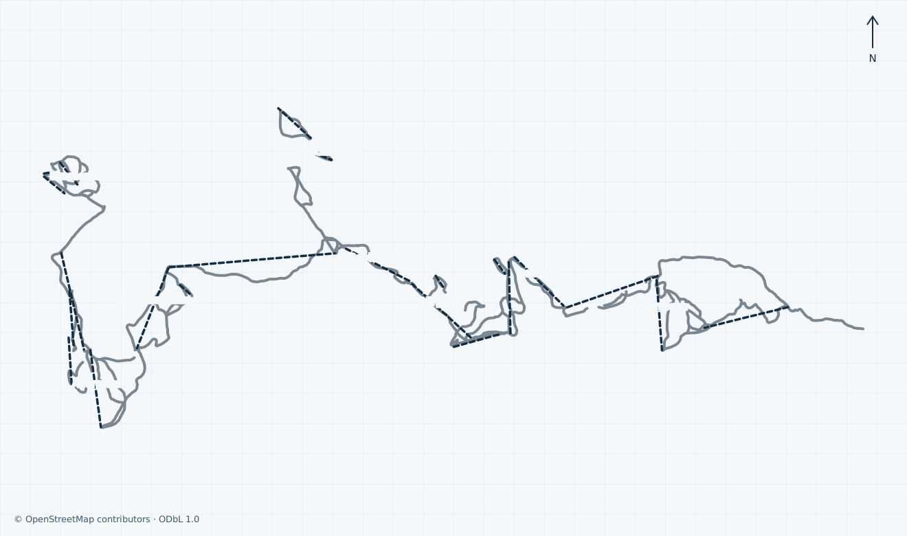
MAPS / UNDERSTAND THE AREA
See how the mountain connects.
Explore mapped pistes and lifts, compare the official plans and choose the right starting base. Check current opening separately.
↑ N
Open for skiing
Closed today · opening within 14 days
Closed for skiing
Unknown / uncertain
Colours show the published skiing status or confirmed operating calendar, not whether every lift is running. Check the operator before travel.
Confirmed dates change colours automatically in the place’s local time. Tentative dates, conflicting reports and expired checks remain black.
Independent ODbL geometry covers the managed Maria Alm/Natrun–Aberg, Hintermoos–Hinterthal, Dienten and Mühlbach downhill corridors. Separate Hinterreit and Hochkeil, Knappensteig touring, private and technical features, unnamed downhill ways and alignments with explicit location doubts are omitted. Hochmais is named by the operator but its OSM alignment is explicitly guessed and is excluded. The Natrun baby-lift type differs between OSM and the operator, so that alignment and the unverified Toni carrier are omitted. Community segments are not the advertised 120 piste kilometres or 34-lift inventory. Only literal sourced colours are used; generic OSM difficulty remains grey. The snapshot uses the actual Overpass replication timestamp. Unconfirmed: the operator map landing advertises a 2026/27 piste plan, but the actual artwork edition, exact geometry comparison and preview or reproduction rights are not established. Operator artwork is omitted. Geometry does not establish opening, grooming, legal access, avalanche safety, navigation or a complete return.
Access: Natrun and Aberg are distinct entry choices; the operator lists Sonnbergbahn, Sinalcobahn and Hochmaisbahn within the wider connected network.
Choose your lesson base and open local route; Natrun scenic operation does not establish skiing or a full connection.
02
Dienten
Access: Gabühel, Bürglalm, Dachegg and Zachhofalm serve the central area and connections toward the neighbouring villages.
The operator’s earliest November programme is limited to named lifts; it is not the complete Königstour.
03
Mühlbach
Access: Karbachalmbahn, Fellersbachbahn and Kings Cab serve the managed downhill area.
Hochkeil is separate. There is no inter-village skibus between Dienten and Mühlbach; confirm a complete on-snow return.
01
Start: choose Maria Alm, Dienten or Mühlbach
Choose the exact lesson and rental base first. Natrun and Aberg are separate Maria Alm entries; Dienten is the central village and Mühlbach uses the Karbachalm side. Parking is limited.
02
Connect: check the complete Königstour first
The operator advertises a six-peak red-piste-ability circuit, with yellow/orange direction arrows. Its complete-area plan starts on 5 December, later than the selected November lifts; Hochkeil and Hinterreit are separate.
03
Return: confirm every lift and transport link
Unconfirmed: final skier boarding, downloading rights and the last complete return between all three villages are not established. Ask staff about every required connection before setting out; the public lift closing time is not a safe departure time for a cross-area tour. There is no inter-village skibus between Dienten and Mühlbach.
Plan around your starting village, the exact seasonal lift programme and every return connection. The Königstour is an experienced-skier circuit; nearby Hochkeil and Hinterreit remain separate areas.
Connected three-village terrain with separate smaller neighbouring ski areas
Detailed partial-opening plan and three seasonal lift timetables
Independent ODbL map with explicit return and historical bus limits
Choose the right village and local grade
The operator describes up to 120 piste kilometres across Maria Alm with Hintermoos and Hinterthal, Dienten and Mühlbach. Ski amadé advertises 34 lift facilities for the wider region. These figures are attributed regional claims, not a count of our selected map lines, currently open routes or a verified complete inventory.
The Königstour is advertised as a six-peak circuit with 35 continuous piste kilometres and 7,500 cumulative vertical metres. The operator requires the ability to ski red pistes and marks the directions with yellow or orange arrows. Start from the appropriate village and plan a shorter outing if the full circuit, weather, ability or available time is unsuitable.
Local reports distinguish easy, intermediate and difficult pistes. Follow the signs and current conditions on site; no universal grade conversion is implied. Snowparks, training slopes and family features have separate availability and requirements. Hochkeil and Hinterreit are separate smaller ski areas, even where a wider pass is accepted.
Unconfirmed: the operator map landing advertises a 2026/27 piste plan, but the actual artwork edition, exact geometry comparison and preview or reproduction rights are not established. Operator artwork is omitted. The independent community map omits doubtful identities, neighbouring areas and technical/private terrain; it is not a navigation or avalanche-safety product.
Historical: Patrick-Emil Zörner’s 14 February 2010 photograph looks from Langeck/Aberg toward the Steinernes Meer. It does not establish today’s snow, buildings, lift layout or access. Original JPEG bytes retained; responsive CSS display crops only.
Use the exact seasonal lifts and return connections
The operator lists Natrunbahn, Sonnbergbahn and Abergbahn for the Maria Alm entry area, with chairlifts and surface lifts across Aberg, Hintermoos and Hinterthal. Dienten has Gabühelbahn, Bürglalmbahn, Dacheggbahn and Zachhofalmbahn; Mühlbach has Karbachalmbahn, Fellersbachbahn and Kings Cab. Their roles and hours differ. A lift running for sightseeing is not evidence that ski pistes or sector connections are open.
Conflicting sources: Ski amadé lists an expected 28 November 2026 start for all three villages, ending on 4 April 2027 in Maria Alm and 29 March in Dienten and Mühlbach. The operator instead specifies selected lifts on 28–29 November, Dacheggbahn, Zachhofalmbahn and Liebenaulift on 4 December, the complete area including Königstour from 5 December through 29 March, and only Aberg from 30 March through 4 April. All these plans remain subject to snow and weather; a date range does not guarantee every lift or a complete return.
Through 31 January, the operator’s winter table lists Karbachalmbahn/Fellersbachbahn and the Natrunbahn/Sonnbergbahn/Abergbahn/Natrun surface-lift group at 08:30–16:00. Kings Cab, the other listed Maria Alm lifts and the listed Dienten lifts are 09:00–16:00. These are conditional seasonal hours for operating facilities, not a daily opening guarantee.
From 1 February through 29 March, Karbachalmbahn/Fellersbachbahn are listed at 08:00–16:00, Kings Cab at 08:30–16:00 and the Natrun/Sonnberg/Aberg group at 08:15–16:00. The main Maria Alm and Dienten chairs/gondolas start at 08:30; listed smaller lifts start at 09:00. Dienten’s Liebenau, Wastlhöhe and Zachhof baby lifts are listed to 16:15. For 30 March–4 April, only Abergbahn at 08:15–16:00 and Abergalmbahn/Schönangerbahn at 08:30–16:00 are listed.
Unconfirmed: final skier boarding, downloading rights and the last complete return between all three villages are not established. Ask staff about every required connection before setting out; the public lift closing time is not a safe departure time for a cross-area tour.
Plan parking, public transport and both directions
Maria Alm, Dienten and Mühlbach are different entry villages. Select your accommodation, rental collection and lesson base before choosing a valley station. The approximate Maria Alm pin is a village planning reference, not proof of a parking entrance, boarding route or accessible connection.
The operator advertises free parking at valley stations but warns that spaces are limited. It lists charging at Karbachalmbahn, Skizentrum Dienten, Hochmaisbahn and Abergbahn. These listings do not reserve a parking place or establish charger availability. Check current road and weather information before travel.
The arrival page advertises free local skibuses serving accommodation, railway access and lift bases. It also describes a one-day Salzburg public-transport arrival ticket downloaded using an eligible pass or booking number, with boarding within Salzburg province. Check the exact product and route conditions rather than assuming any journey is included.
Historical: the arrival page still labels its downloadable skibus schedules 2025/26. Unconfirmed: final 2026/27 routes, last buses and individual accessible transfers are not established. The operator expressly says there is no inter-village skibus connection between Dienten and Mühlbach.
The official 2026/27 ticket page separates day and multiday tickets, Ski amadé ALL-IN Card White/Gold, SuperSkiCard, pedestrian products and regional offers. Select the correct activity, age group and travel dates; a pedestrian ticket or pass-validity period does not establish ski operation.
Online prices vary with season, purchase time and demand. The operator lists a EUR 3 KeyCard deposit and says ski tickets are personal and non-transferable. Its ticket machines support card payment and can provide purchases or online-ticket collection depending on the location.
Machines are listed around Natrun/Aberg, Hintermoos, Hochmais/Faschinglift, Dienten and Mühlbach. Confirm the actual pickup point and whether a compatible card can be reloaded. Wider pass acceptance at the separate Hochkeil and Hinterreit areas does not create an on-snow connection to them.
Unconfirmed: a complete fixed 2026/27 price for your date, age and chosen pass is not established here. Prices vary with season, purchase time and demand; verify the final product, inclusions, restrictions and applicable refund terms before paying. The tariff page links 2026/27 price sheets but retains a general-conditions download labelled 2025/26.
Respect piste closures and choose a manageable circuit
Use prepared open marked pistes, obey patrol, closures and local grades, and adjust speed to ability, visibility and traffic. Ski amadé directs readers to FIS rules and current avalanche information. A mapped line, snow on an archive photograph or an operating gondola is not permission to enter closed or unsecured terrain.
The operator states that pistes are closed from 17:00 until 08:00, changing to 17:30 until 08:00 from 1 February, and warns of lethal winch-grooming hazards and absent safety provision. Observe the local police ordinances and their specific exceptions; the general guide grants no uphill, night or after-hours access. Separately listed touring tracks require their own current conditions and rules and are omitted from this downhill map.
The Königstour requires red-piste ability. Confirm its current opening, direction, all connections and return plan before leaving your base; do not use the last lift closing time as the time to start crossing the area.
Ski amadé lists mountain rescue 140 and the European emergency number 112. Give your exact location and follow local instructions. Unconfirmed: individual patrol arrangements, medical opening hours, adaptive equipment and a complete assisted boarding/evacuation route are not established; arrange specific needs with the responsible provider before travel.
The regional directory lists ski schools in Maria Alm, Hinterthal, Dienten and Mühlbach, including Ski & Snowboard Schule Sport Klaus Mühlbach, and separate rental outlets. Confirm the precise meeting point, ability group, age requirements, equipment, lift-ticket inclusions, fitting and final equipment return with the booked provider.
The operator advertises ski depots and lockers across Maria Alm, Dienten and Mühlbach; Ski amadé also identifies the Natrun valley-station depot. Capacity, access and opening hours depend on the actual outlet. Huts, restaurants and accommodation have independent seasonal operation; their availability does not establish skiing.
Ski amadé lists Aberg–Hinterthal–Bergbahnen AG in Maria Alm on +43 6584 7301 and Hochkönig Bergbahnen GmbH for Dienten/Mühlbach on +43 6467 7214. The regional tourism information service lists +43 6584 20388. Use the correct lift company or booking provider for operational and reservation questions.
Unconfirmed: final 2026/27 lesson/rental availability, individual assistance and a continuous step-free journey from transport or parking through the chosen base and lift are not established. Agree the exact arrangements before booking or travelling.
Selected source-checked references only. Use the complete official plan for the network; this list is not the resort’s total piste count or live opening report.
04 / AT THE BASE
Facilities that change the day.
Village ski-school and rental listings have separate meeting points, bookings and return times. Free valley-station parking is limited; ski depots and lockers are listed across the three villages. Tourism offices and lift companies are distinct contacts; individual assistance must be arranged in advance.
05 / PROFILE BASIS & SOURCES
What this profile is based on.
This profile is based on current information published or supplied by the place or its operator and the dated sources linked below.
SOURCE CHECKED
Initial ten-scope primary-source review includes composed web-component DOM, exact partial calendar, three seasonal lift tables, managed-area scope, ticket conditions, closures, transport and assistance limits.
AUTHENTIC OPEN-LICENSE PHOTO · 2026-11-05
The hero image is an authentic photograph by Patrick-Emil Zörner (Paddy), reused under the CC BY-SA 3.0 license.
Historical: Patrick-Emil Zörner’s 14 February 2010 photograph looks from Langeck/Aberg toward the Steinernes Meer. It does not establish today’s snow, buildings, lift layout or access. Original JPEG bytes retained; responsive CSS display crops only.